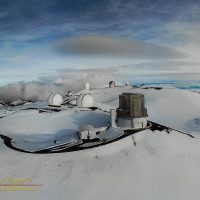
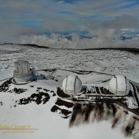
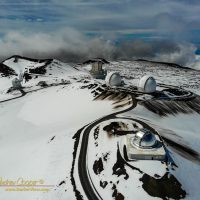
Governor Ige signed the new public access rules, drones would be illegal on the summit in ten more days.
With a deadline looming much sooner than I had contemplated there was a narrow window of opportunity. While I had wanted to fly the summit for a long time, I now had a few short days in which to do so. On January 23, 2020 the new rules would take effect.
The Office of Mauna Kea Management has attempted to restrict drone use on the summit by posting signs that drones are not allowed. Problem, they did this with no legal authority to do so. In conversations with OMKM staff I had pointed this out and received a quiet admission that it was true.
The new public access rules would change this… Flying a drone would be specifically prohibited on the science reserve, a civil offence with steep fines involved. With the governor’s signature those rules would be in force.
I had set a few conditions for myself that had to be met to fly…
- Conditions must be safely flyable… Low winds, clear enough for good visibility, must be able to follow FAA drone rules. Winds on the 13,803ft summit limit flyable days to a fraction of the time.
- The road must be open to the public as we observatory employees are not allowed to engage in recreational activities on the summit when others are not allowed to do the same.
- Fresh snow would be a big plus, I was waiting for this.
- The humidity must be high enough that the submillimeter telescopes are unable to observe as the drone’s radio might interfere.
- I had to drive to the summit in my own vehicle so I would not be “at work” when I flew.
I had a bit over one week left… Then it snowed.
The worry now was the forecast, it called for a string of bad weather days, and the clock was ticking. For a couple days the drone stayed in the vehicle, the road was not open, and the weather foggy and windy.
On Tuesday, January 14th, 2020 everything came together.
Unexpectedly I had to head to the mauna to fix a broken dome. With the possibility of good conditions I charged the drone batteries and packed some other photo gear. Arriving at Hale Pōhaku I discovered that the road was open to the public. Maybe? Instead of parking at Hale Pōhaku I drove to the summit in my vehicle.
The weather was not only flyable, it was spectacular.
Sunlight streamed over the fresh snow atop the summit. Spectacular clouds surrounded the summit at all sides, sometimes threatening to overwhelm the clear skies, but never actually doing so.
I had informed OMKM a couple days earlier that I was going to fly. I had spoken to Scotty, the head Mauna Kea ranger and informed him of my plans. He was not happy, and pointed out a few things I had already planned on like the road open rule, but he and I both knew he had no way of prohibiting the flights. He did threaten to keep the road closed for the next ten days until the new rules were in force. I think he was joking, maybe.

I flew a total of eight flights, several before starting the day’s work, several after leaving work. I would have flown more, but I could only charge my batteries so quickly.
I shot stills and video, I shot panoramas, I shot photo spheres, I shot as much as I could. I made a number of video passes by Keck, taking advantage of the beautiful light to get great footage.
The Mavic Air performed admirably in the thin air, maneuvering well, holding position properly. The Air is rated to 5,000m altitude in the manufacturer’s specifications, much higher than Mauna Kea’s 4,207m summit. It was notably slower in climbing and I did get a number of “max motor speed” warnings when climbing. Battery life was also short, managing a bit over ten minutes each flight rather than the twenty or so I would get at lower elevation.
There is a distinct lack of photographic vantage points on the mauna, good places where you can photograph the telescopes and scenery from, at least from the ground. Those that do exist are photographed to death. The drone frees you of that restriction, you simply maneuver until the telescopes are properly positioned for your composition.
As I landed the drone that last time I realized I would never be able to fly here again. My batteries expended the Sun was setting into the clouds and I was losing the light.
With the rules now in place it would still be possible to fly with a permit issued by either OMKM or the state film board. I do not expect those agencies to ever grant such a permit. I have heard that commercial photographers have requested such permissions from the film board, only to be denied. If you are thinking of flying the summit… Forget it.
Mission complete, new rules now in place, pau.


Very pretty
You are in possession of some of the rarest and beautiful video ever captured.
A hui hou!
Spectacular shots and insightful comments as always!
U been gone for awhile. Hiding fm Covid?
Good idea
Aloha