There is a way to leave Sitka without entering the open ocean, a sheltered waterway that leads to Juneau and the rest of Alaska. The passage from Sitka to the open waters of Chatham Straight is in places very narrow, a series of passes and straights that lead inland, the last section found on the charts as Peril Straight. The passage is plied by dozens of vessels daily including the Alaskan State Ferry.
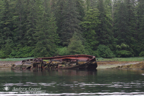
In a narrow passage just north of Sitka, a place called Neva Straight lies the wreck of a tugboat, a vessel that failed to make the journey. A rusted reminder to be careful in navigating these waters.
The wreck of a tugboat in Neva Strait north of Sitka, Alaska
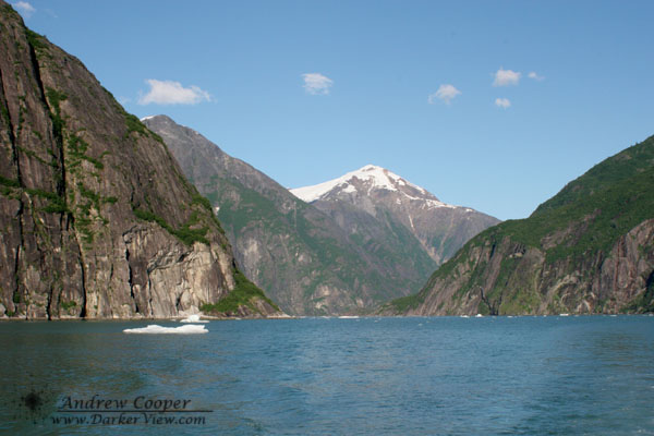
Tracy Arm is one of the must see places near Juneau. If you are not traveling in your own boat you can jump on one of the fast excursion boats that make the run from Juneau each day. A classic fjord with walls that tower thousands of feet above, waterfalls everywhere, and icebergs to make navigation interesting as you make your way up the glacially carved canyon. The terrain beneath the water is just as dramatic, not unusual to be a few hundred feet from shore with a thousand feet of water below the keel. In some places the depth finder can not find bottom, over 1,200 ft or more down.
At the top there is Sawyer Glacier, a tidewater glacier that drops those icebergs into the water as you watch. There are actually two glaciers, in twin arms of the fjord that separate near the end of the trip. Sit among the ice flows watching the seals and ice crashing from the cliff-like face. If you can time your arrival for high tide it is far more likely to see a really big calving, with hundreds or thousands of tons of ices breaking free from the face to crash into the water and create waves that rock the boat.
It is customary to scoop up some of that glacial ice floating around to fill your coolers. Crystal clear and very dense, the ice from the bottom of the glacier is interesting stuff. We break it up and make cocktails out of it to enjoy as we cruise back down the fjord.
Looking up Tracy Arm, a classic fjord in southeast Alaska
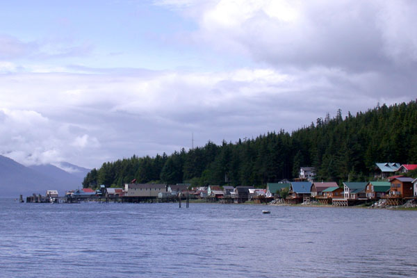
If we are anywhere near on schedule I should be in Tenakee Springs today. Tenakee is one of those places in the world that is just special. The town is quite simple, a single line of homes and a few businesses along the shore for about one mile. The center of town is found at the seaplane dock and the general store. At the far eastern end, half a mile down the shoreline, are the state docks where anyone can tie up a boat for a small nightly fee.
View Larger MapGoogle Map of Tenakee SpringsThe town has one main road, unpaved, where almost all the traffic is on foot. A few ATV’s, wheelbarrows and pushcarts haul groceries and other cargo. There are a couple trucks in town, one is a large pickup with a water tank that serves as the local firetruck. A daily float-plane run connects the town with the rest of the world. The only other way to get to Tenakee is by boat, taking most of a day to get from Juneau.
There really are springs at Tenakee, wonderful hot springs that supply water just right for bathing. The springs are the reason why the town is located here, endless hot water available to douse the cold of an Alaskan winter. To take advantage of this water there is a public bathhouse constructed over the main spring. Male and female bathing is handled by alternating hours of access. Sitting in the bath and enjoying the water one evening I was talking to one of the local guys, he made the comment of having “seen half the town naked, the wrong half!”
Tenakee Springs is a place where man lives, but nature rules. Stray very far out of town and you quickly enter wilderness. This remains the only place I have had a close encounter with a grizzly bear, way too close, just a 100yards from the state marina while on the beach. There is a great story there, one I will save for another time.
The general store is a place that would not have been out of place in most towns of the American west back in the 1930′ or 1940’s. A clapboard building found right in the center of town on the waterfront, right next to the float plane dock and the helipad. A single large room with a small selection of all the necessities. One wall serves as a gift shop and gallery for local artists, selling watercolors and other artwork to those of us who are just visiting.
Looking forward to returning here, taking a bath in the hot spring, and generally enjoying a bit of rural Alaska.
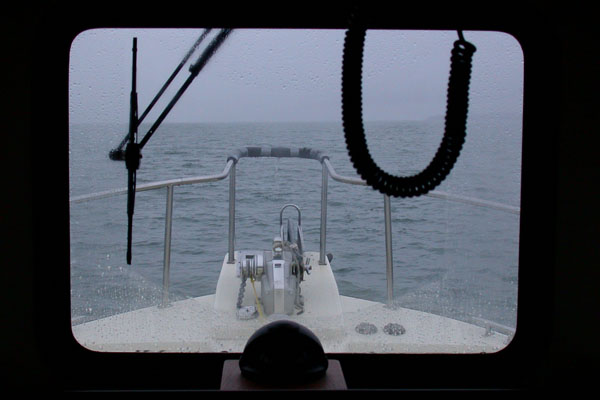
The weather can be glorious, grey and cold, or simply miserable. I have experienced trips with nothing but sunny days and temperatures allowing shorts and sandals. Other times have brought rains that equaled anything I have seen, when it seemed the sea was both above and below. Sailing through narrow, rocky passages with nothing but radar to see the shore a few hundred feet away, shrouded in fog.
You take what you get on a trip, no way to reschedule now. Rain or shine, fog or mist, each can be beautiful in their own way to an traveler willing to enjoy the experience, whatever life brings.
A grey view out the wheelhouse window of the Chrisara on Chatham Straight, 3 July 2004
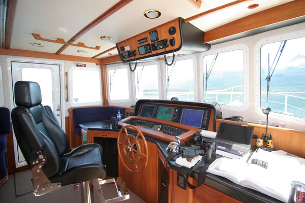
The bridge of the Nordic Star, home for the next three weeks. I will be spending many hours at the wheel as we explore. There are two marine radios above along with a stereo system with CD player. (Note to self, put together a few CD’s of my playlists). On the dash are three flat panel displays that can be configured to display the GPS, marine charts, radar and depth finder display. The view is the best in the boat, aside from climbing to the upper deck. Also visible is the usual clutter of charts, binoculars, camera gear, radios, drinks and munchies.
The spacious bridge of the Nordic Star, a 52′ Nordic Tug
July is here and my long awaited Alaska trip is at hand. For a three weeks I will be exploring the waterways of SE Alaska aboard a 52′ motorboat. Crewing for my father as we enjoy a family escape from the world. I hope you have been enjoying the post so far.
One aspect of this trip is the nearly complete severing of net access after we leave harbor. No internet, no e-mail, no cell phone, no blogging for nearly the better part of a month!
This will be tough.
I will have a netbook along, with the ability to at least compose postings and process my photos. There may be a couple opportunities to get e-mail and post, but they will be fleeting and I have no idea just how much I may get done in the few days we will be in port to resupply and pick up other family members and guests.
I have scheduled a series of postings to give my readers something while I am out of contact. Mostly photos, Wordless Wednesdays and similar stuff, nothing with any immediacy. If a world-shaking event does happen to occur, it may be days before I find out. Most of the posts are photos and observations from past trips to Southeast Alaska, so between the scheduled posts, and all of the inevitable new stuff when I get back online, Darker View is going to be a bit of an Alaska blog for the next month.
I will also be highly restricting commenting for the three weeks as I will not be able to stop by and moderate. No sense in giving the spammers a free ride. If you need to comment or contact me your best bet is to drop an e-mail. Those at least will be sitting in a que for me to deal with.
When I am again connected to the world I expect to have hundreds of photographs and many stories to tell. Look for a flood of postings and additions to the gallery!
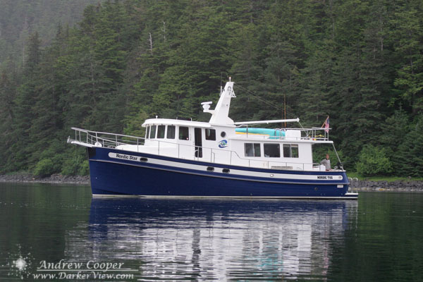
The 52′ Nordic Star built by Nordic Tugs of Bellingham anchored in Kalinin Bay on our 2006 trip
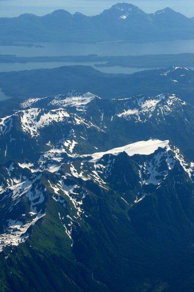
The view from the aircraft window as typical Southeastern Alaskan scenery slides by, the interior of Admiralty Island with the Glass Peninsula in the backgroundThe topography of Southeast Alaska is beautiful beyond words. Tremendous mountains carved by glaciers. These left huge valleys flooded when the glaciers retreated and the sea levels rose at the end of the ice age. The result is a boater’s paradise, endless passages, bays and coves to explore, with mountains towering overhead. What roads exist usually end a few miles from town and the only real way to get about is by air or by boat.
A land where man does not quite rule, cities and towns are far apart and wilderness surrounds. Travel very far in any direction and you soon leave civilization behind.