The Bears of Pavlof

After the aborted shore mission at Iyoukeen Cove, we were not done for the day, there would be more bears.

A grizzly bear fishing at Pavlof Harbor
We knew there was yet another opportunity to see bears, under somewhat safer conditions, just around the corner in Freshwater Bay. Pavlof Harbor is a small cove off the bay that offers a small river that tumbles over a low waterfalls right at tideline. If there are fish in the river, there will be bears fishing here. As this is still Chichagof Island, they will be grizzly bears, there are no black bears here.

As we entered Pavlof harbor we were surprised as a float plane came overhead and landed along the northern shore. The plane quickly beached a few hundred yards north of where the river enters the cove and disgorged a group of passengers, the plane deparing as soon as the passengers were off. While we set about anchoring the Quest in the cove, they got a briefing from their guide and slowly walked along the shoreline trail to the river.

In binoculars we could see at least two bears at the river. It looked like these folks were getting what they paid for, a chance to see and photograph grizzlies fishing in the river. Deciding to give the other group a head start we broke out the chow and had grilled cheese sandwiches for lunch.

Continue reading “The Bears of Pavlof”

Inside Passage… One Last Time

OK, you can stop asking for the new Inside Passage video… It is done!

It has bears! Whales! Sea lions! Grizzly bears! Aurora! Lots of drone footage! More bears!

Actually the video came together pretty well. I already had a piece of music picked out, that saved a great deal of trouble. Nearly four weeks on the water meant a great deal of photographic material to work with. As usual the Inside Passage provided plenty of photographic opportunity, particularly the first week when is seemed like even the wildlife was performing on cue.

And there were lots of bears…

The Ruins of Namu

There are fewer and fewer good ruins to explore along the Inside Passage. This last year saw one of the best set of ruins bulldozed and burned.

The Ruins of Namu
The collapsing waterfront of the abandoned cannery at Namu
The region is littered with abandoned canneries, mines, and shipwrecks, ample material for those who wish to explore and photograph. I must count myself among those who seek out such places.

The steamship stop and cannery at Buttedale is no longer the picturesque set of collapsing buildings it was when I last visited two years ago. We made a swing through the cove this year to note that most of the structures were gone, replaced with blackened ground and foundations. Just a few buildings and the large steam engine remain.

We did not go to Ocean Falls this year, it is a fair ways off the primary cruising route and we had a great visit a couple years ago. Instead I planned for Namu, a large abandoned cannery on Fitz Hugh Sound I had not had a chance to explore before.

A visit to Namu was not assured on this passage. With our alternator repairs and planning for a crossing of Queen Charlotte Sound before bad weather set in, time to explore the cannery might easily get crossed off the schedule.

Continue reading “The Ruins of Namu”

The Mavic Air QuickShots

One of the compelling features of the DJI Mavic drones are the quick shot capabilities. These are programmed maneuvers that the drone performs while rolling video. Properly used these pre-programmed shots can be stunningly effective.

Testing the boomerang quickshot of the Mavic Air
So far my favorite is the new boomerang shot, introduced in the Mavic Air. Check out the video to the right for an example of what these quick shots can do…

Continue reading “The Mavic Air QuickShots”

The Mavic Air Panorama Modes

One of the most useful features of the Mavic Air are the built in panorama modes. These are pre-programmed maneuvers, like the quick-shots, that take a series of exposures to stitch into a single frame.

Mauna Kea above the Morning Fog
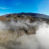
Mauna Kea seen above morning fog, a Mavic wide panorama of nine frames
The panorama feature was offered in earlier models like the Mavic Pro, the difference in the Air is that the stitching is done on-board, ready to download from the SD card as a finished product at the end of the flight, no need to process in the DJI software.

There are two panorama modes I find myself using regularly. The spherical and horizontal modes both offer a view from the drone that overcomes the limitations of the camera.

Continue reading “The Mavic Air Panorama Modes”

Flying a Drone in Canadian Airspace

OK, I have the FAA rules for operating a drone figured out. What about Canada? As I will be voyaging along the Inside Passage this month I intend to fly in Canadian airspace. The scenery of the wild British Columbia coastline is just too fantastic to pass up, particularly from the air.

Flying the Drone
Flying the Mavic Air along the R1 road on the side of Mauna Kea
Yes, again I am writing a blog post so I can research and remember a subject for myself. A good way to study a subject I need to know, in this case it is Canadian drone rules.

Rules for drones in Canada are the responsibility of Transport Canada, the equivalent of the US Federal Aviation Administration. TC maintains a very nice set of web pages covering drone rules and regulations. There is even a nice PDF page that summarizes the rules.

In general Canadian drone rules are much more restrictive than the FAA drone rules. For example the range limits are 90 meters above ground, notably lower than the US 400ft rule. Operation must be at a maximum range of 500m, where the US allows up to visual line-of-sight, potentially several miles.

Continue reading “Flying a Drone in Canadian Airspace”

B4UFly and AirMap

Learning where you can, and cannot fly is a basic part of learning to pilot a drone. To aid this there are several mobile applications that a pilot can use to check the airspace status of a potential flying site. Just scroll that map and select a site to see the warnings.

Flying the Drone
Flying the Mavic Air on Mauna Kea
First there is the official FAA app B4UFly available for both iOS and Android. There is also a notable alternative in AirMap, a third party application that uses the FAA database to accomplish the same task.

I have downloaded and used both for flight planning applications around the island. The island of Hawaiʻi offers some spectacular scenery that has made learning to fly the drone quite enjoyable.

Basically the official FAA B4UFly application sucks. A blunt expression, but appropriate, it truly does.

Continue reading “B4UFly and AirMap”