
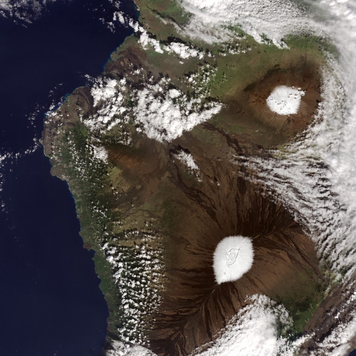
Recent snowfall atop Hawaiian summits as captured by NASA’s OLI imager aboard Landsat 8 on Dec 25th, 2016
Snow may not be the first thing that comes to mind when you think of the Hawaiian Islands. But nearly every year, the peaks of Mauna Kea and Mauna Loa volcanoes are temporarily dusted with white. Satellites captured such events in 2014, 2015, and most recently in December 2016, pictured here.
The Operational Land Imager (OLI) on the Landsat 8 satellite captured these natural-color images of the snowy peaks on December 25, 2016. A storm on December 18 brought not only snow, but bouts of thunder and lightning. While snow in Hawaii is not unusual (it can even fall in summer), thundersnow is less common.
The storm was reportedly associated with a Kona low. This low-pressure system brought a change in wind direction, such that winds that typically blow out of the northeast shifted to blow from the southwest. The winds from the leeward or “Kona” side drew moisture from the warm, tropical Pacific that ultimately fell as snow over the high elevations.