
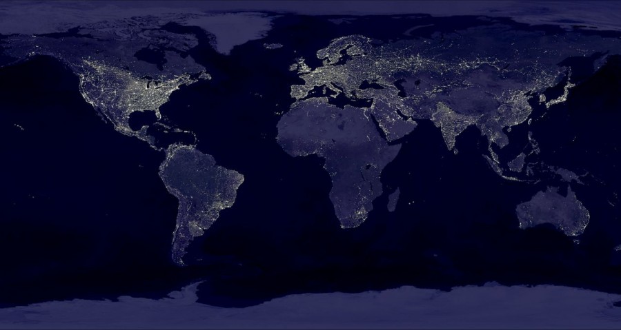
A view of the Earth compiled from nighttime shots from the DMSP satellites during October 1994 to March 1995. Image credit NASA/Goddard Space Flight Center
The Nighttime Lights of the World data set is compiled from the October 1994 – March 1995 DMSP nighttime data collected when moonlight was low. Using the Operational Linescan System (OLS) thermal infrared band, areas containing clouds were removed and the remaining area used in the time series. This image is actually a composite of hundreds of pictures acquired by three of the four DMSP satellites, which operate in low-altitude polar orbits and have the unique capability to detect low levels of visible-near infrared (VNIR) radiance at night. Credit: NASA/Goddard Space Flight Center