
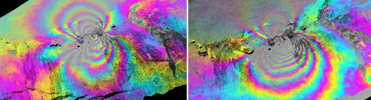
Color-enhanced UAVSAR interferogram images of Hawaii’s Kilauea volcano, taken between January 2010 and May 2011. Image credit: NASA/JPL-Caltech
Color-enhanced UAVSAR interferogram images of Hawaii’s Kilauea volcano, taken between January 2010 and May 2011. The images show the east rift zone of Kilauea, about 6 miles (9.7 kilometers) from the summit caldera. Lava has been flowing from the east rift zone, the most active part of Kilauea, since 1983. Image credit: NASA/JPL-Caltech