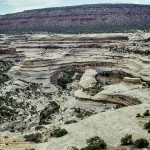
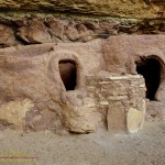
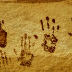
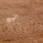
Still working on scanning the slide collection, I will probably be at it for years. Worth it though, so many memories. Here are a few images from a visit to Natural Bridges National Monument in 1993…
When you want to see the stars, find someplace dark

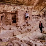
Still working on scanning the slide collection, I will probably be at it for years. Worth it though, so many memories. Here are a few images from a visit to Natural Bridges National Monument in 1993…
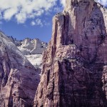
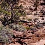
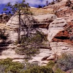
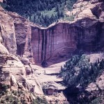
Between semesters at college I loved to hit the road. The usual destination was the great parks along the Utah and Arizona borders including Zion…
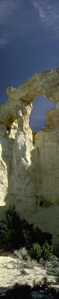
The road to the arch is a short-cut from Page, Arizona to Bryce Canyon NP in Utah. The choice is 150 miles around via Kanab, or 50 miles through the wilderness, 40 miles of which is on dirt road. But what a road, through the heart of wild sandstone country, passing Grosvenor Arch, Kodachrome Basin State Park and thousands of acres of countryside that would be a state park anywhere else in the country, except that here in Southern Utah this is considered ordinary.
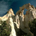
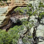
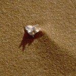
It is possible to climb to the top of the arch if you go around to the east. Here there is a steep slope leading to the top of the small ridge behind the arch. The slope is littered with crystals of selenite weathered from the soft rock. When you reach the top you are presented with a view through the arch from above. DO NOT climb out onto the arch however, unless you really don’t want to explore the rest of this marvelous region.
Forty miles of dirt road is not to be traveled lightly, check with the Kane Co. sheriff department or with local residents at Big Water or Cannonsville about road conditions. The first ten miles of the south end of the road is made from bentonite clay. For those unfamiliar with this wonderful/horrible material let me say this. When mixed with water there is nothing slimier or stickier than bentonite. It will instantly coat the thickest tire tread with several inches of slick mud, reducing traction to nil. I have driven this road when wet, with a four wheel drive, and it was.. interesting. If there has been any measurable rainfall avoid the road for a while. This is not to scare you off, when dry the road is normally passable for a standard passenger vehicle without trouble. When in the backcountry ALWAYS CARRY EXTRA WATER and some other minimal survival equipment is a good idea.
The times I have driven this road I have entered from the south off of State Highway 89, going north. The road wanders for a while across the prairie before entering the canyon that you will follow all of the way to the arch. The geology here is alternately bentonite clay, mudstones and sandstones. There are even some small slot canyons for those who look for them. The turnoff for the arch is signed with the typical BLM wooden signs and is a mile or so off the main road. Continuing on north from the arch you will climb out of the valley and will be treated to views across miles some of the best of Utah’s sandstone countryside. A few miles more brings you to the turn for Kodachrome Basin State Park. Do make this turn for the wild and often comical sandstone scenery. The State Park has an excellent campground with showers. The stone pillars the park is known for are everywhere, there is one that stands over the campground looking exactly like a thirty foot tall piece of male anatomy.
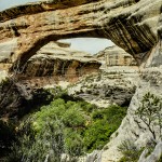
The arch itself stands above a small dirt loop at the end of the side road. There are even a few facilities put in by the BLM at the arch, a single picnic table under a steel roof and an outhouse. Nothing fancy, but few who venture this far off the main roads expect a four star hotel.
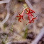
When you reach the arch take a while and smell the Juniper, listen to the pinyon jays, just enjoy a remote corner of this beautiful region.

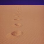
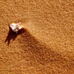
At first the dunes seem devoid of animal life, with few plants struggling to keep hold in the shifting sand. But a closer look revealed traces of more than is first apparent. Tracks criss-cross the dune slopes. Traces of lizards, beetles and snakes that scavenge a life out of the sand. Here or there is a larger reminder, maybe the tracks of a rabbit or coyote showing where the game of life was played for another round. And there in the sand a trace of death as well, in a small vertebra, a reminder that life is easily ended in this sea of sand.