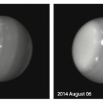
Weather on any planet can be quite unpredictable. As hurricanes threaten the Aloha State, astronomers working at W. M. Keck Observatory on the island of Hawaii were surprised by the appearance of gigantic swirling storm systems on the distant planet Uranus.
Massive storms on Uranus captured August 5 and 6, 2014 as seen by Keck Observatory. Credit Imke de Pater (UC Berkeley)/Keck ObservatoryDuring the Voyager encounter with Uranus in 1986, only a scant handful of dim clouds were seen in its atmosphere. When the planet approached equinox in 2007 (i.e., when the Sun stood high above its equator), large storms developed on the planet, yet most of these faded.
In the past few days, however, astronomers were surprised by a multitude of bright storms on the planet, including one monstrous feature.
“We are always anxious to see that first image of the night of any planet or satellite, as we never know what it might have in store for us,” said Imke de Pater, professor at UC Berkeley and team leader. “This extremely bright feature we saw on UT 6 August 2014 reminds me of a similarly bright storm we saw on Uranus’s southern hemisphere during the years leading up to and at equinox”.
Now at the summit doing a last walk through the facility to insure everything is ready for the storm. A lot of the gear has been turned off to preserve the battery and generator capacity, keeping the network and the key servers operational so we can monitor remotely once everyone leaves.
The winds are picking up, some 60mph gusts along the summit ridge, a little less where Keck sits on the western side. Looking to the east we can see some cloud features that might be the front wall of the oncoming storm.
We plan to depart the summit in another hour and head for home. I expect the drive down to be as clear as the drive up, mostly clear with wild cloud formations over the summits.
Eighteen gallons of drinking water sitting in jugs in the guest bathtub, all of the lanai furniture is stashed away, a supply of propane is on-hand, the vehicle tanks are full… We are prepared for the storm.
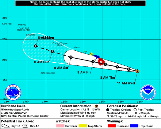
Considering that Iselle has failed to weaken as the earlier predictions forecast, it is now going to hit the island as a full hurricane. The cone of possible paths has narrowed to where there is no doubt, the eye of the storm will come right over the island.
I have never experienced the center of a hurricane, this will be new. Getting brushed by the outer edge of hurricane Howard while in Mexico a decade back is as close as I have been before. If the predictions hold we will see the eye go right over us. It will also be interesting to see what the interaction with two nearly 14,000ft mountains will do to the storm.
I am not expecting damaging winds on our side of the island. Perhaps a lot of rain? My worst fear is an extended power outage. There is a lot of Alaskan halibut in the freezer that would be painful to lose. I have filled the remaining space in the freezer with water bottles, now ice, to increase the thermal mass and the hold time without power.
I am on the minimal summit crew that will head up first thing tomorrow morning. We depart at the usual 7am and hope to be off the summit before noon. Certainly before the storm makes landfall later in the day. In any case tomorrow will be an interesting day.
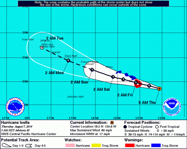
Hurricane Iselle approaching the island of Hawai’i
Iselle is now forecast to hit the island as a full hurricane. The most likely path has shifted a little south, aiming directly for Puna. This may get interesting!
The forecast for hurricane Iselle as of Wednesday morning
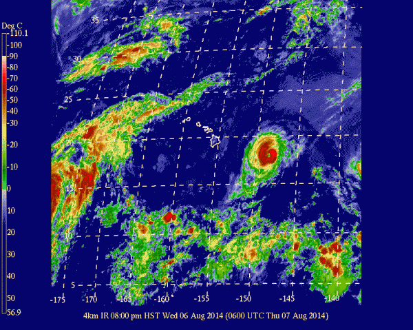
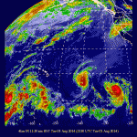
A GEOS infrared image of the Eastern pacific on the afternoon of August 5th. Visible are three hurricanes… Genevieve, Iselle and Julio (west to east)First up is hurricane Iselle, currently a category 2 storm with 110mph sustained winds. Fortunately the storm is expected to weaken and cross the island as a mere tropical storm on Thursday. The track does predict that the storm will come right over the island, bringing heavy rains and possibly damaging winds.
Behind Iselle is Julio, now 1900 miles southeast of Hilo. This storm is expected to cross the island as a hurricane, the first hurricane to hit a Hawaiian island in over two decades. This is the storm everyone is watching. It is still a bit early, the storm is not expected to arrive until Sunday. The forecasts will be interesting and well read over the coming days.
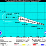
The forecast path for hurricane Iselle, 5 Aug 2014Fortunately our house is on the lee side of the island from these approaching storms, and is somewhat better sheltered than many of our neighbors. Storm preparations are quickly accomplished… Secure any outside furniture and gear, and insure we have a little extra water and propane on hand.
Preparations at the observatory are notably more complex.
The major concern is an extended power outage. We rely on long power lines that cross the saddle between Mauna Loa and Mauna Kea. If one or both of these storms prove damaging the power lines are likely to be part of the damage. These lines are also likely low on the list of repairs if there is extensive damage across the island.
Yes, there is a backup generator on site with a storage tank filled with diesel. How long will it last? What if the power lines along Saddle road are damaged? The power lines to the summit may be low on the priority list to repair if there are lines down all over the island.
If we are without power for a long period, we could lose power when the generator runs out of fuel. Of first concern are the instruments… The sensitive interiors of these cameras and spectrographs are kept at cryogenic temperatures, hundreds of degrees below freezing. Without power the instruments will start to warm up. Returning the instruments to service can take weeks. The vacuum dewars will have to be pumped again to restore the high quality vacuum conditions, then the instrument carefully cooled again.
Not that we are plunging blindly into this. We have a plan. Shutting down as much as we can, with priority given to the instruments. Hopefully the worst will not occur and we can continue smoothly on. But if the island does take damage we will be prepared to weather out the worst of it and preserve the facility.
A reminder that there is the possibility of a strong meteor shower this evening. The Earth may pass through a cloud of debris left by comet 209P/LINEAR. Sky watchers should observe around 21:00 to 22:00HST on the evening of May 23rd.
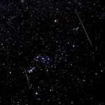
A pair of Leonid meteors streak through OrionNorth America and the North Pacific is favored for visibility. If it occurs the peak will be short and sweet, lasting about an hour. Fortunately for us in the islands this is predicted for mid-evening hours, from 7-8UT on the 24th (21-22HST on the 23rd). Predictions for the shower range from minor to spectacular. The meteors will seem to radiate from a part of the sky occupied by the dim constellation Camelopardalis, thus some are dubbing this shower the Camelopardalids.
For Hawai’i the radiant will be low in the north, about 20 degrees above the horizon, near Polaris. This means that any meteors we see will be hitting the atmosphere at a low angle. Combined with the low speed of the meteors this could lead to very showy bolides streaking across much of the sky.
As with any meteor shower, any predictions are to be taken with a large dose of skepticism. It is important to point out that meteor prediction is not an exact science, rather a bit of an art form. In this case there are any number of unknowns involved, we could see nothing, we could see a true meteor storm. This event could be anything from “meh” to “oh wow!!!”. To their credit, the folks making these predictions have been impressively right on several recent showers.
I would strongly suggest that you at least take an effort to step outside after 9pm on Friday evening and see what the sky has to offer. All you need is a clear dark sky.
The meteor wildcard of 2014 is something new. Several meteor experts are predicting a possible shower from comet 209P/LINEAR. The Earth will pass close to the debris stream from this comet in late May this year, possibly creating a decent meteor shower, or even a meteor storm.
A pair of Leonid meteors streak through OrionI could write up the whole description, or just let you read a nice summary from the IMO website…
Of greatest potential significance this quarter, indeed this year, is an encounter between the Earth and a number of dust trails left by Comet 209P/LINEAR at its perihelion returns within twenty years to either side of 1900 AD. Several predictions have already been issued for what may occur, and further updates are likely nearer the event. Based on the most recent independent calculations by Esko Lyytinen, Mikhail Maslov and J´er´emie Vaubaillon, the strongest activity from this source should happen on May 24, most likely between about 07h to 08h UT from a radiant near the borders of Lynx, Ursa Major and Camelopardalis, quite close to o UMa. The predicted radiant locations fall within a few degrees of α = 124° , δ = +79° . Timings in UT for the centre of the strongest activity overall are around 07h 03m (Lyytinen), 07h 21m (Maslov) and 07h 40m (Vaubaillon) respectively.
However, much is unknown about this comet, including its dust productivity and even its precise orbit. Consequently, while tentative proposals have been made that ZHRs at best could reach 100+, perhaps up to storm proportions, based purely on the relative approach distances between the Earth and the computed dust trails, these are far from certain. The strongest activity could be short lived too, lasting perhaps between a few minutes to a fraction of an hour only. In addition, the number of dust trails involved means there may be more than one peak, and that others could happen outside the “key hour” period, so observers at suitable locations are urged to be vigilant for as long as possible to either side of the predicted event to record whatever takes place.
Remember, there are no guarantees in meteor astronomy! Lunar observing circumstances are very positive, with May’s new Moon on the 28th. The north-circumpolar radiant area for many sites means the three main geographic zones where most radio observers are located – Europe, North America and Japan – should be able to follow all that occurs, interference permitting. The time of year means the northern nights are close to their shortest for visual and imaging work, but the predicted strongest activity timings fall perfectly for night-time coverage all across North America and the nearby oceans to its east and west.
–IMO Website 2014 Calendar
The takeaway from what we know… This shower is highly uncertain, we could get anything from nothing to meteor storm. The peak will be short and sharp, lasting only a few hours. With a peak near 07:00-08:00hUT on May 24th, observers in the Pacific should be alert from 21:00 to 22:00HST on the evening of the 23rd. New Moon occurs on the 28th, indicating there should be no moonlight to contend with.
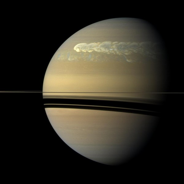
The huge storm churning through the atmosphere in Saturn's northern hemisphere overtakes itself as it encircles the planet in this true-color view from NASA's Cassini spacecraft, image credit: NASA/JPL-Caltech/Space Science Institute
This picture, captured on Feb. 25, 2011, was taken about 12 weeks after the storm began, and the clouds by this time had formed a tail that wrapped around the planet. Some of the clouds moved south and got caught up in a current that flows to the east (to the right) relative to the storm head. This tail, which appears as slightly blue clouds south and west (left) of the storm head, can be seen encountering the storm head in this view.