
Grizzly Fishing
When you want to see the stars, find someplace dark

After the aborted shore mission at Iyoukeen Cove, we were not done for the day, there would be more bears.

As we entered Pavlof harbor we were surprised as a float plane came overhead and landed along the northern shore. The plane quickly beached a few hundred yards north of where the river enters the cove and disgorged a group of passengers, the plane deparing as soon as the passengers were off. While we set about anchoring the Quest in the cove, they got a briefing from their guide and slowly walked along the shoreline trail to the river.
In binoculars we could see at least two bears at the river. It looked like these folks were getting what they paid for, a chance to see and photograph grizzlies fishing in the river. Deciding to give the other group a head start we broke out the chow and had grilled cheese sandwiches for lunch.


OK, you can stop asking for the new Inside Passage video… It is done!
It has bears! Whales! Sea lions! Grizzly bears! Aurora! Lots of drone footage! More bears!
Actually the video came together pretty well. I already had a piece of music picked out, that saved a great deal of trouble. Nearly four weeks on the water meant a great deal of photographic material to work with. As usual the Inside Passage provided plenty of photographic opportunity, particularly the first week when is seemed like even the wildlife was performing on cue.
And there were lots of bears…


There are fewer and fewer good ruins to explore along the Inside Passage. This last year saw one of the best set of ruins bulldozed and burned.
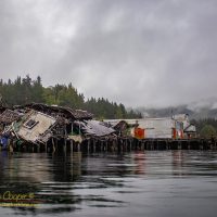
The steamship stop and cannery at Buttedale is no longer the picturesque set of collapsing buildings it was when I last visited two years ago. We made a swing through the cove this year to note that most of the structures were gone, replaced with blackened ground and foundations. Just a few buildings and the large steam engine remain.
We did not go to Ocean Falls this year, it is a fair ways off the primary cruising route and we had a great visit a couple years ago. Instead I planned for Namu, a large abandoned cannery on Fitz Hugh Sound I had not had a chance to explore before.
A visit to Namu was not assured on this passage. With our alternator repairs and planning for a crossing of Queen Charlotte Sound before bad weather set in, time to explore the cannery might easily get crossed off the schedule.
