
Another weekend, another puʻu… So last week I climbed the wrong puʻu. This weekend I climbed the right puʻu.
Reaching this hill one travels a couple miles down the R-1 road, the Ka Aliali Trail. A couple of miles of 4WD road to bounce over. The road is not that bad, but I would recommend a true 4WD vehicle. DLNR requires a 4WD vehicle based on the signs, not that everyone reads the signage at the start of the road.
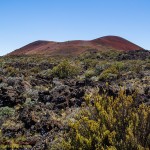
Unlike last weekend there was no heavy fog to obscure the landscape as I reached the area. My goal was obvious… the big red puʻu just downslope from the road. There is a short secondary road, signed R-2 that leads into the area between the two hills. After about a quarter mile this road fades at the edge of an aʻa flow. After parking I got out and sat on a rock outcropping for a while with a snack. The area is just pretty, the jagged black lava and native plants. I finished a bag of chips, downed a water bottle and simply enjoyed the view.
Puʻu Kole is notably harder to ascend than Puʻu Palaolelo. I suspected I was on the wrong puʻu last weekend when it was too easy, reaching the top after a quick stroll in the fog. Puʻu Kole is nearly twice as high, as least when approaching from the upslope side.
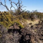
Despite the difficulty, the aʻa field was really pretty. Native bushes like pukiawe, hinahina and ʻohelo ʻai grew amongst the boulders creating an effect prettier than many deliberate gardens. It may have taken time and effort to cross, but the walk was worth it.
With the aʻa behind and below it was the steep cinder slope that was the next challenge. The loose material threatening to betray each step, sliding underneath your feet. I slowly side-hill up the slope, taking advantage of a couple level shoulders on the northern flank. For a mere two mile stroll it takes some effort to climb a cinder cone.
Unlike Puʻu Palaolelo, Puʻu Kole has a beautiful, intact crater at the top. Actually there are two craters. Climbing the north flank you come to a smaller side crater, beyond that is the much larger main crater.
Descending into this main crater I had the impression of being some hapless insect that had stumbled into an antlion’s trap. The steep, loose cinder was so reminiscent of those little pits. I do not recall having ever explored such a nice crater on any of the previous cinder cones I have hiked to.
Yellow deposits with a trace of sulfur remaining betrayed an area of fumaroles. The white and yellow deposits also cementing the cinder into something more like solid rock.
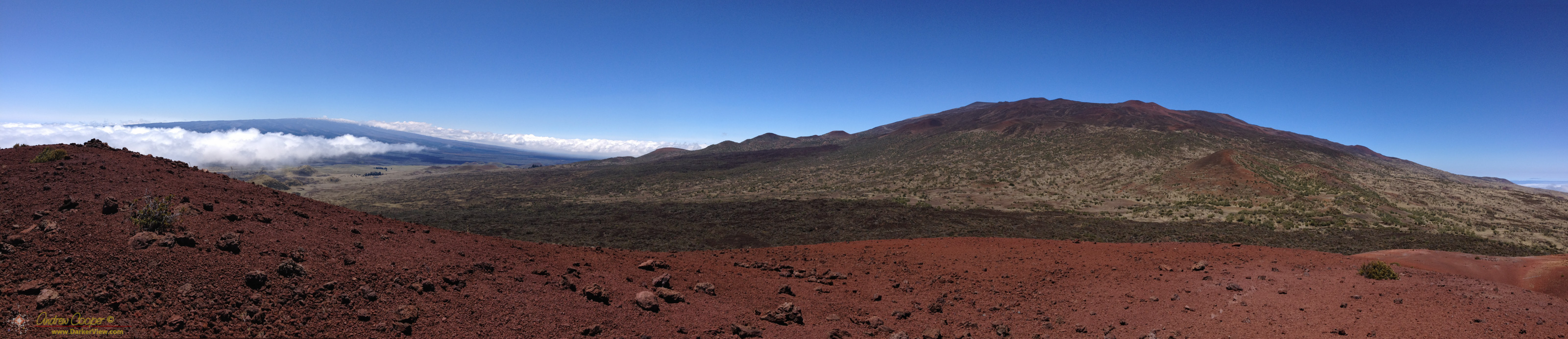
The highest side of a cinder cone usually betrays the direction of the prevailing winds during the eruption. The winds push more flying cinder downwind, to one side of the forming cone. The high side of Puʻu Kole is the western rim, to be expected if the trades were blowing well during the eruption. They certainly were when I topped the summit of the cone.
Atop the cone the vantage point also allows one to appreciate the extent of the lava flows that poured out from the base of the cone, from the same eruption. Puʻu Kole is the source of the aʻa flow I had to cross. The flow traveled for some miles down the flank of Mauna Kea, the lower extent hidden under the vegetation lower down the mountain in the satellite imagery. At one point on the western flank you can see where a flow emerged from under the cinder, a thick tongue of lava reaching out from the base of the cone.
Not only very pretty, this area offers enough to write a few chapters in a geology textbook. There were no spectres or fogbows on this walk, but it was no less fascinating.

excellent report