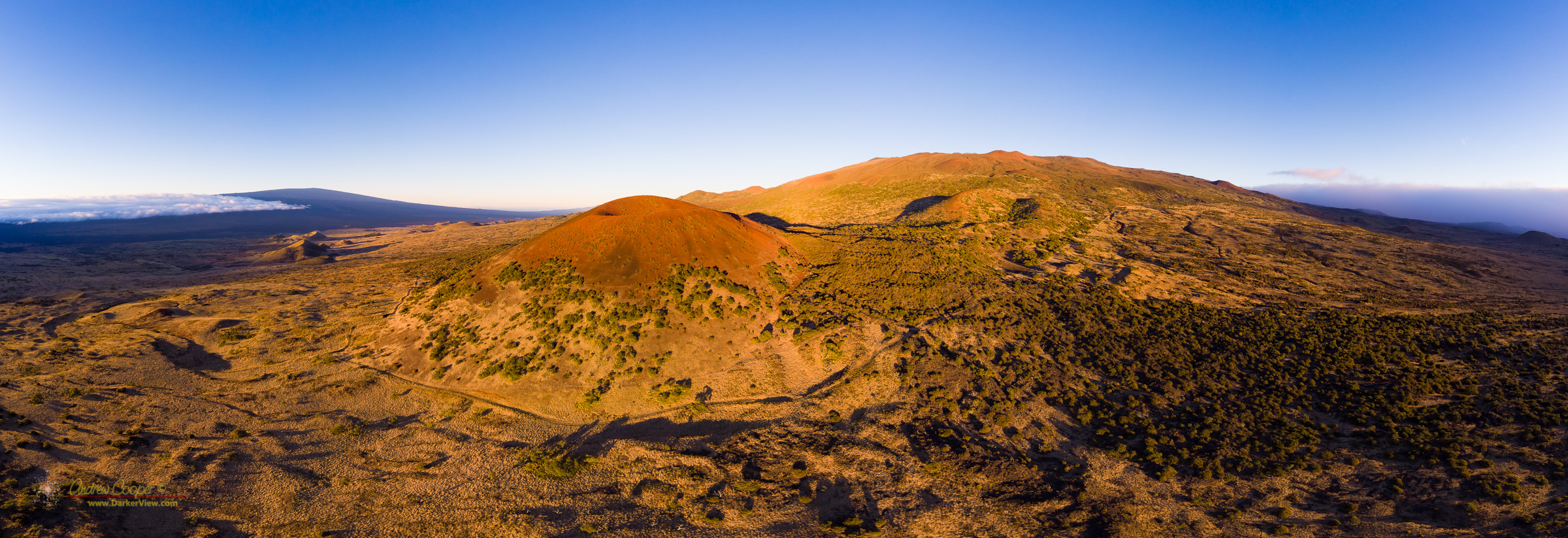
Puʻu Kole Panorama
When you want to see the stars, find someplace dark

How bored do you have to be to make a video of a walk to a hill just a few miles from the house?
Yeah, that bored.
A combination of still and drone photography with a Mavic Air.
I did get out of the house for a few hours.
After two weeks of being stuck at home I really wanted to get out and stretch my legs. A hike is in order.
The governor specifically allows outdoor exercise in his stay-at-home order, including “surfing, swimming and walking pets”. I took that to cover a local hike near home. Just outside Waikoloa Village are quite a few rough roads that allow access to big areas of land, much of which belongs to the village association.
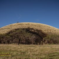
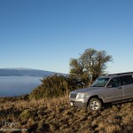
Puʻu Hinai would be my destination, a prominent landmark that sits 200 feet above the surrounding plains, a feature that I have seen on every commute for 13 years and wondered what was out there. A short walk of about a mile off of Waikoloa Road it was an easy target.
A large part of the puʻu has been carved away by a cinder mining operation. A decade ago trucks carrying cinder were a common sight on Waikoloa Road, no longer, the quarry lies abandoned. The side of the puʻu that faces the road is mostly untouched. The far side? It appears much is gone, I wanted to see just how much.
Continue reading “Exploring Puʻu Hinai”
Another weekend, another puʻu… So last week I climbed the wrong puʻu. This weekend I climbed the right puʻu.
Reaching this hill one travels a couple miles down the R-1 road, the Ka Aliali Trail. A couple of miles of 4WD road to bounce over. The road is not that bad, but I would recommend a true 4WD vehicle. DLNR requires a 4WD vehicle based on the signs, not that everyone reads the signage at the start of the road.
Unlike last weekend there was no heavy fog to obscure the landscape as I reached the area. My goal was obvious… the big red puʻu just downslope from the road. There is a short secondary road, signed R-2 that leads into the area between the two hills. After about a quarter mile this road fades at the edge of an aʻa flow. After parking I got out and sat on a rock outcropping for a while with a snack. The area is just pretty, the jagged black lava and native plants. I finished a bag of chips, downed a water bottle and simply enjoyed the view.
Puʻu Kole is notably harder to ascend than Puʻu Palaolelo. I suspected I was on the wrong puʻu last weekend when it was too easy, reaching the top after a quick stroll in the fog. Puʻu Kole is nearly twice as high, as least when approaching from the upslope side.
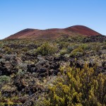
The original plan had been to hike Puʻu Kole, a dramatically red cinder cone visible from the summit access road. The red coloration leads to the name, Kole, which translates as red.
What actually happened is that I climbed the wrong puʻu.
As I traversed the R1 4WD road the side of Mauna Kea was enveloped in heavy fog, thick enough that you could not see a hundred yards, sometimes less. I was pretty sure I was in the vicinity of the target, and sure enough the shadow of a large puʻu was visible in the mist. So I parked the vehicle and climbed it.
It was when I reached the top and looked downhill that I noted there was another puʻu hiding in the fog. It was then I realized that I might just be on the wrong hill. Checking the maps I realized that I had climbed Puʻu Palaolelo.
Wrong? Perhaps this is the wrong word, there was no particular reason I needed to be on the right puʻu other than my desire to explore a place I had seen so often while ascending or descending the summit road. The error was fortuitous in that my original target hill was enveloped in thick fog all morning, while Puʻu Palaolelo, a little higher on the mountain, was alternately in the fog and in the sunlight.
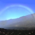
Standing atop the puʻu I could not miss the beauty of the morning. Still early the low sunlight was rich in color. Across the saddle you could see Mauna Loa, capped in vivid white, quite a contrast to her black lava flows. A chill wind swept fog over the summit, at times I was spattered with droplets. As the fog and light played across the landscape my camera memory card quickly filled. It was a satisfying hike, resulting in some pretty photos. My original goal of climbing Puʻu Kole lies unfulfilled, an excuse for another walk on the mountain.
Pu’u dot the landscape of the Island of Hawai’i. Pu’u, (pronounced poo-oo) is an interesting Hawaiian word that can mean hill, bump, pimple, wart, or any similar concept, but in this case generally means cinder cone. These reminders of the volcanic origins dot the sides of the big volcanoes like pimples on the face of the island. They are everywhere and each has a traditional name. Locals have used them since the dawn of civilization on the islands to give directions, describe legal land boundaries and name roads throughout the island.
Learning your way around the island is often learning the names of the Pu’u. I use them to mark my progress along my morning commute to work and note the weather above Wiamea. A large pu’u stands above the end of Saddle Road where it turns into the center of the island and another pu’u marks the intersection of Saddle Road and the Mauna Kea access road that climbs to the summit winding through the pu’u that cover the flanks of the mountian. Keck Observatory itself sits on the rim of Pu’u Hou ‘Oki.
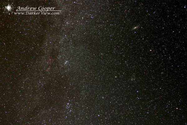
The West Hawaii Astronomy Club’s dark sky observing site sits directly beside a small pu’u that goes by the name of Pu’u Kuainiho in a unit of State DLNR land named for Pu’u Anahulu. Nothing fancy, a large gravel lot just off a major state highway, but far anough off to avoid the headlights. Easy to find along the road from Waimea to Kona. It sits at about 2,000ft elevation, high enough to be above most of the low altitude tropical haze. Being in the rain shadow of a 14,000ft peak the site offers surprisingly reliable weather, it is often cloudy in the evening but almost always clears after dark. The only real issue is the often heavy formation of dew and some ground mists that will plague observers. The site is a comprimise between fairly decent skies offered by lower elevations here in Hawaii and the truly spectacular observing that can be had from sites high on the side of Mauna Kea at 9,000ft. The only issue is that those perfect Mauna Kea skies are accessed by a rough hour long drive up Saddle Road and are often windy and quite cold. Sometimes a warm site 15min from home on a good road wins the toss.
This time the target was meteors, a shower I had often not observed because it generally occured in the middle of Tucson’s rainy monsoon season. But a dark sky with no Moon and access to a decent dark site a few minutes away was simply too attractive. Except, of course, for the 2am setting in the alarm clock. I had expected a few other observers to be out for the peak, but when I got to the site I was alone. No matter, nothing new for me. I had brought along the Losmandy mount and the DSLR for a little attempted meteor photography and a lounge chair for relaxed meteor observing.
Set the mount up, a quick polar alignment with a polar scope good enough for wide field photography, bolt the camera on and let it go. Just lie back in the chair with a couple blankets and I am set!
OK, start the show now…
…I must have waited five minutes for the first meteor.
But meteors did appear. A few dim ones widely scattered and a few bright ones from time to time to annouce that something out of the ordinary was going on. I kept a few rough counts to do a quick estimate of rates using the camera’s shutter interval as a timer. I would get three to five every five minute interval giving rates of around 30-60ZHR. Nothing spectacular, just a decent show as the Perseids are so well known for. Though after the true Leonid meteor storm I witnessed in Tucson a few years back anything else does seem a little tame.
As for the photographs? A careful examination of every photo shows a staggering number of meteors were captured by my extensive photographic effort. I had to painstakingly go though each photo to come up with a grand total of…
zero.
I did get a nice photo of the Perseus-Cassiopea region of the Milky Way however…