One of the most useful features of the Mavic Air are the built in panorama modes. These are pre-programmed maneuvers, like the quick-shots, that take a series of exposures to stitch into a single frame.

There are two panorama modes I find myself using regularly. The spherical and horizontal modes both offer a view from the drone that overcomes the limitations of the camera.
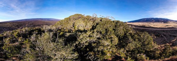
The horizontal panorama is a mosaic of nine frames. In effect creating an image as if from a much wider angle lens. The horizontal panorama is just the thing to capture an expansive view that will not fit into a single frame.
The spherical panorama offers a drones eye view of an entire landscape that can be viewed in a 360 panorama viewer. While the result offers a compelling image it does take an investment of time to produce. The drone will hover and spin to capture 25 images to create the sphere, a process that takes well over a minute of valuable flight time.
The spheres produced are big, 32 megapixels of image stored to the SD card. Good thing the large SD cards are pretty cheap!

One issue with the spherical panorama images produced by the Mavic is that they are missing the needed EXIF tags for most web services to recognize them as panoramas. In order to load the image to Google Maps or Facebook takes a little EXIF hacking. Only one tag need be added to Facebook, but Google Maps requires quite a bit more to properly use the image.
Another issue is that the stitching software has issues keeping a horizon straight. The results can be a bit haphazard in both the 180 wide and the spherical panorama modes with the horizon appearing a bit askew.

An effect that appears to be a flaw in the images, but is a true reflection of reality is caused by shadow hiding. Many of the 180 panoramas look to have a bright region exactly opposite the Sun. This is caused by a real phenomena, the image appears brighter where rough ground or foliage casts no shadows due to the angle of the sunlight, while other areas of the image appear darker due to shadows.
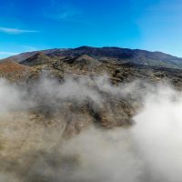
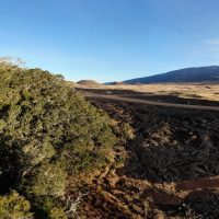
Shadow hiding is particularly visible in the images shown here, taken over the very rough terrain of a’a lava flows in the Humu’ula Saddle
Click to load the image in the viewer. I have loaded it at full resolution so it will take a while to load, have patience.

