
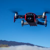
For a new drone pilot, learning the rules can be a bit daunting.
Hawaiʻi is a state that is incredibly attractive to a drone pilot. The scenery, from reefs and beaches, to the soaring volcanoes, just begs to be flown over and photographed from the air.
I am determined to fly responsibly, that means going through all of the various rules. The rules are not simple! They are a patchwork of regulations from federal, state, and local authorities. How do you make sense of it all?
Below is the results of my research on the subject. More than a few hours of reading state and federal websites. The process of writing this post was in itself a means of educating myself. Hopefully others will find this useful. If you know of anything I have missed, drop me a line to let me know.
This post is focused on the Island of Hawaii, home for me. But much of what is discussed here applies to all of the islands.
Federal Rules
So who can make rules governing the operation of drones? Notably the FAA makes it very clear that while the land is under the jurisdiction of the local authorities, the air belongs to the FAA. The agency has recently emphasized that federal rule-making, as embodied in 14 C.F.R. part 107, preempts state and local laws on the use of airspace by drones.
Congress has provided the FAA with exclusive authority to regulate aviation safety, the efficiency of the navigable airspace, and air traffic control, among other things. State and local governments are not permitted to regulate any type of aircraft operations, such as flight paths or altitudes, or the navigable airspace.
FAA Press Release 20 July 2018
Basically state, county and municipal governments are free to make rules governing where drones can land and take off, once in the air the rules are 14 C.F.R. part 107. This is certain to be tested in court as numerous local laws seek to address drone use, it will be interesting to see the outcome.
Cities and municipalities are not permitted to have their own rules or regulations governing the operation of aircraft. However, as indicated, they may generally determine the location of aircraft landing sites through their land use powers.
FAA Press Release 20 July 2018
FAA no-fly zones are covered in detail using the FAA mobile application B4UFly. This app supposedly provides the definitive map of where you can, and cannot fly according to the FAA database of US airspace.
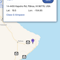
Supposedly? The FAA official app is clearly missing some restrictions, during the 2018 Kilauea eruption B4UFly did not show the TFR over the ongoing eruption in Puna, not a small problem. People were getting arrested and drones siezed, yet the official app showed it clear to fly. I generally rely on Airmap instead, but keep both on the phone to check.
Those federal restrictions? Basically airports, military bases, some sensitive sites like power plants and sport stadiums, and the national parks. Even the National Park Service is restricted by the FAA rule making mandate for airspace.
The National Park Service does not outright admit it, but if you read the official park service FAQ on drone use it becomes clear that they are operating under the same restriction in rule making as state and local authorities wherein they can only regulate the takeoff and landing from park lands.
Keep in mind that if you skirt the letter of the rules, perhaps overflying a national park from another launching point, you may have to deal with an overzealous official or law enforcement officer who does not understand these regulations. Make your own judgement, and take your own risks on this point.
When perusing the online maps of allowed airspace on the island there is one curious and potentially troublesome wandering red line. All the way up the Kona coast, from Hōnaunau south of Kona to the very north tip of the island at Upolu you will find the Ala Kahakai National Historic Trail. Administered by the National Park Service the maps mark the trail as red. Does this mean the entire coastline is off limits?
Keep in mind the conversation above. The Park Service does not own most of the trail, only the sections actually in one of the historic sites like Puʻuhonua O Hōnaunau, Honokohau, and at Puʻu Kohala Heiau. The remainder is a set of easements. You should probably not launch or recover on the coastal trail itself. No problem, it is easy to step off it a ways.
One often overlooked prohibition is the Hawaiian Islands Humpback Whale National Marine Sanctuary which covers much of the water off the Kona Coast. Under the authority of the Marine Mammal Protection act and the Endangered Species Act is is illegal to operate a drone near the whales in this area…
…operating any aircraft above the sanctuary within 1,000 feet of any humpback whale except when in any designated flight corridor for takeoff or landing from an airport or runway or as authorized under the MMPA and the ESA
Title 15, Chapter IX, Part 922, Subpart Q, Section. 922.184, Prohibited Activities
Thus you can fly over sanctuary waters along the Kona and Kohala coast, but must avoid coming within 1,000ft of any whales within the sanctuary area. While not mentioned in the rules I would avoid spinner dolphins in the coves and bays where they rest, simply a matter of courtesy to these animals.
Local Laws and Administrative Rules
What about local laws in the state of Hawaiʻi? There is currently very little local legislation concerning drones in the state, despite attempts to change this… In the 2019 legislative session there was SB622 that sought to criminalize certain types of drone activities, and a resolution urging the congress and the FAA to make it possible for local authorities to regulate drone use… Both failed. This has been typical in recent legislative sessions.
The 2021 legislature is again attempting to restrict drone use, if in a more modest form… HB448 and SB680 are the house and senate versions of the same bill. Both are attempting to add drones to the general provisions on invasion of privacy regulations. Having read these rules it comes down to whether or not the sky is an “area generally open to the public”, something that will probably have to be tested in court.
In the absence of specific laws restricting drone use there are relatively few Hawaii state rules governing drone operation. What exists are restrictions that could be put in place through administrative rules rather than legislative changes to the law. State parks are off limits, as are natural area reserves. Both have specific rules governing the operation of drones from within the area. Though in the case of NAR lands you might argue the definition of conveyance…
To operate any motorized or unmotorized land vehicle or air conveyance of any shape or form in any area, including roads or trails, not designated for its use
DLNR Title 13, Subtitle 9, Chapter 209 – Rules Regulating Activities Within Natural Area Reserves
State forest reserves cover a much larger amount of land than the parks or NAR lands, particularly here on the island of Hawaii. Island wide these reserves cover some very scenic areas, wide open land ideal for drone use.
The reserves are of particular interest to me as much of the land upon Mauna Kea is forest reserve. This includes areas I used for my initial drone flights while learning and continue to fly as the landscape is spectacular.
While state forest reserves are not currently off-limits, there are proposed rule changes in process that would restrict UAV operation to permit only. The proposed rule change package faced substantial opposition, not over the drone issue, but over access and a new authority for the DLNR chair and board to create emergency area closures. While the rule package has been approved by the DLNR board it has sat on the governor’s desk unsigned for some time now. Thus approval of this rule package is very much uncertain at this time.
O13-146-9 Aircraft. No person shall land or launch aircraft, as defined in section 261-1, HRS, including airplanes, airships, balloons, gliders, hang gliders, helicopters, parachutes, dirigibles, and other similar means of conveyance except with the written permission of the board or its authorized representative or in the case of an emergency.
Title 13, Subtitle 6, Chapter 146 Hawaii State Parks Administrative Rules
State parks have been deemed off limits for drone use as the use of aircraft in the park was already covered by the administrative rules. The drone ban can be found explicitly on the state park website and on signs at the parks. Note the prohibition shown above covers launching and landing only, in accordance with FAA regulations.
The Big Island
When planning a flight the largest issues on the island are the airports, the state and national parks. If the forest reserves become restricted that will put a good deal of the island off limits.
Of the specific landmarks on the island?
I am often asked about Mauna Kea… The University and OMKM manage the lands above 11,000ft and have designated the summit as a no fly zone. This includes the access road above the visitor center at Hale Pohaku.
In early January, 2020 Governor Ige signed the Mauna Kea public access rules that specifically prohibits drone use without a permit on the university managed lands of Mauna Kea, this is the area immediately around the buildings at Hale Pohaku and most everything above 12,000ft elevation. This removes the ambiguity regarding drone at the summit as the Mauna Kea rangers had previously attempted to enforce the rule with no legal foundation.
The new rules take effect January 23, 2020 and the rangers can cite drone flyers with stiff fines involved. If you wish to fly on Mauna Kea you can request a permit from OMKM, but in all likelihood it will be denied.
State parks like Akaka Falls and Hapuna Beach are no-fly zones, or as discussed above no launch or land zones. Hawaii County parks have no drone rules and are open for flying. These parks contain any number of good beaches and other very attractive places to fly.
I should note that several fliers have reported being harassed at county parks by parks employees stating that drone use is illegal (see comments below). With no official county rules on the subject this appears to be overzealous enforcement, no surprise.
Keep in mind that the big resorts are private property and each may set their own policy on operating a drone. The beach and shoreline however are always public property in Hawaiʻi, even in front of private land. You may get hassled by resort security, but they really have no legal right to stop you if operating from the beach.
Most of the Kona and Kohala coastline is clear, as long as you step off the Ala Kahakai National Historic Trail. Waipio Valley is open to drones, as is the smaller Pololu. The waterfall rich Waimanu Valley is open, but watch for the sightseeing helicopters that fly into the valley, often quite low to view the waterfalls.
Most of Mauna Loa is open, except for the summit caldera and a slice of the south side covered by the national park.
All of Hilo and Kona north of Honokohau Harbor are close to the airports and would require notification or LAANC clearance in accordance with FAA rules. Kona itself, including Kailua Bay is wide open.
It is probably best to consider the port at Kawaihae a no-fly zone as it could be considered critical infrastructure, which likely includes the Pua Ka ‘Ilima ‘O Kawaihae Cultural Surf Park. I might also avoid the HELCO power plants at Keahole, Kanoelehua, and similar, but this advisory is not well defined at this point in time.
Of course the military practice range at the Pōhakuloa Training Area is off limits. The range boundaries are clearly shown on Airmap, while in B4UFly the range sometimes does not show up while planning a flight nearby.
Another large piece of land that is off the table is Hakalau Forest National Wildlife Refuge, several large tracts of forest on the side of Mauna Kea. These are clearly marked in Airmap and not properly shown in B4UFly.
Ka Lae (South Point) and Green Sands beach is in the clear. There are very few restrictions over the entire south end of the island.
While not official no-fly zones, there are places I will not fly. The palila refuge and trail at Puʻu Laʻau is a beautiful place… Nope. Similarly the ʻAlalā reintroduction area or Hawaiian petrel nesting colonies on Mauna Loa, anywhere near a monk seal on the beach, these should just be added to your no-fly list. Remember to stay away from whales and dolphins as discussed above.
In addition to B4UFly and Airmap, one useful resource I keep handy on the phone is PLTIS, the Hawaii state GIS system maintained by DLNR. This database is an exhaustive listing of government lands in the state in a simple to navigate map format. Click on the parcel and get the name of the landowner. You do have to set up a login account to use, otherwise very easy.
That is what I have so far. I will have to update this posting if the rules change. Now have fun and go fly!
Revisions
A number of revisions have been made to this post to improve accuracy and keep it up to date. Check back for changes if you are flying!
13Aug2018 Added Hakalau NWR to the no-fly notes.
4Oct2018 The FAA issued TFR’s for Puna and Kilauea have expired.
19Oct2018 Added the HELCO power plants as areas that might be considered critical infrastructure to avoid.
19Oct2018 Added a paragraph on PLTIS for land ownership data.
11May2019 No particular changes in the laws or admin rules, nothing on drones appears to have made it through the 2019 legislative session despite several measures being introduced. DLNR still has not adopted the rule package for forest reserves, UH is back out for public comment on the Mauna Kea rules. Added notes above on Mauna Kea and county parks. Updated the state law section on failed legislation.
16Jan2020 Changed the notes on Mauna Kea, after Jan 23, 2020 the summit is a definite no fly zone.
5Nov2020 The DLNR forest reserve rule change as been approved by the DLNR board. This change, which would require a permit for drone use in the forest reserves has been sitting on Governor Ige’s desk unsigned for a while now.
4Feb2021 Added notes on the current legislative effort to add drones to privacy law.

Who is that guy with a challenging hairdo? Lol I should talk.
Did u set up a fishing line on it to catch fish?
Aloha
Have fun on your vacation this year
I notice you say County of Hawaii has no restrictions in their parks. But if you call the County, they say they just follow State park rules. Sounds like they don’t have their own rules, which means they don’t have ANY rules! What do you think?
They indeed have rules, a very nice set of published rules you can read on the county parks and rec website. I have read through them a couple times, and text searched to be sure… There are no prohibitions on drones, or anything that can be considered a drone (unmanned aircraft, RC model, etc.) to be found in these rules. I expect that they will get about changing that someday, but for now the parks are open for flight. Check out rule 8, the general rules for all parks… http://records.co.hawaii.hi.us/weblink/browse.aspx?dbid=1&startid=24878&cr=1
What do you mean with open for flight? So every National and State parks in Hawaii are allowed for flying?
County parks are open for flight, the County of Hawaii Parks and Recreation Department has no rules that regulate drone usage. There are any number of beaches and other great places that are county parks. National or state parks in Hawaii County? No. With a caveat… You can overfly a national or state park, but you cannot stand on park property while you fly.
Happened to me today, county employee told me I could not fly in waipio Park, and county offices person told me they follow state rules but could give me no information or specifics on where to find that in writing. I even stopped at a local police department and ask them and they really didn’t say for sure but they could tell that they were not happy about the idea of flying a drone in any part. Basically they said I could be arrested for disturbing the peace.
Enormously grateful to you for this! Wow, soooo complicated!
Very grateful for this resource and you taking the time to put it together. We will be in Hawaii next week and I’m bringing my Mavic Pro but will also respect any legal NFZ’s. Thanks again!
Mark, just wondering how it went.
Well, I got chased out of the county park on Big Island (Waipio Valley). The county man insisted they follow state law but when I asked him for any referencing information I can find that on he seemed to get more agitated and a “friend” of his came to his aid. He just became more insistent that I land the drone, which I did. I did contact a county commissioner who is over that area (forgot her name) and, while she was nice, she was very anti-drone (VERY). Still, she could not reference any specific place where the county says it is prohibited or any place where there is some statute saying they follow state law in this matter. I was very disappointed. When I drove to the other side of the island I wanted to fly in/around Honopue Valley so I stopped at the last town before there (Kohala?) and went to the police department to ask if it was ok to fly in Honopue Valley. The police officer said a resounding NO. I politely asked him if there where any local statues that I could refer to that prohibits and he didn’t like being challenged and said “you cannot fly your drone in a county park”. I politely asked him how would he charge someone for doing so and he said they would be charged with disturbing the peace and he would do it.
So, I left the Big Island mostly empty handed with drone footage from the county park perspective but did get some flights right off the road near the ocean, and the video was good. I also got good footage on Oahu and Maui.
I do wish that local communities, county, etc., would have something to reference other than “I know you can’t fly your drone legally and you will be fined if you do”.
I would think the easy fix would be to launch the drone from the roadside a few hundred yards away.
I am considering flying over tomorrow to try to get a nice picture of the snow on Mauna Kea(I live on Oahu) and it looks like the snow is melting, but still good for photos. From where can you technically fly on Mauna Kea and still get a nice shot of the summit? I fly 107, so I really don’t want to get in trouble, but it’s hard to tell what is okay and what is not on Mauna Kea. I was imagining it would be possible to start flight legally at lower elevation and climb with the slope to stay under 400 AGL but I’m not sure from what vantage point to shoot the summit so as to catch the telescopes.
I am sorry to report it is longer possible with the new public rules that took effect the 23rd. The snow is above 13,000ft now, UH managed lands start at 11,000ft, well out of the range of standard drones.
Thanks for the followup. Much appreciated!
One thing that I wondered about with the state parks. I understand the beaches (between high and low water marks) are public lands and that is why you can always go on a beach even if the land by it is private. Does that mean if you stand in that area and launch your drone by a state park, you are legally in the clear?
I suspect that would be a no. The state park includes the water resources, it is all public land administered by the DLNR and the parks department.
Thanks Andrew – there is always the roadway behind your vehicle I guess!
Hi Andrew – I downloaded Airmap. Very useful! Going back to that question about launching from the beach by a state park, I noticed that airmap shows state parks, but the shading doesn’t include the beach. Ha’ena state park on Kauai is a case in point. Not sure the rangers would agree but it does seem to be outside the park.
Does anyone know what is considered the ala kahakai national historic trail? Their map shows the area stretching all the way to the water from a few hundred is yards inland, which would make it impossible to fly on the entire west coast of the big island.
It is only the trail itself that the park service claims, a few feet wide. If you really want to avoid it just step off the trail a ways before flying.
Has anyone flown recently in Oahu or Kauai?
Especially in the last year, 2020-2021?
Any recent experiences flying?
Heard that there are more tourists now than at previous times during this pandemic.
I do fly, mostly while out hiking, thus often more remote and away from the crowds. The tourist crowd had substantially picked up, the resorts look busy again, rental cars on the road, beaches are busy.
I used to practice mapping missions over empty ball fields at the Pahoa Community Park until one security guard stopped me, saying he had been called by the park supervisor. He informed me that the supervisor had “proclaimed “ the park a drone no-fly zone. I challenged him to produce any relevant county or state rules or laws prohibiting it, which he could not. I of course acquiesced and now comply, although I calmly stated my objections , stating that as long as I am not overflying people and following FAA rules, I am within my rights. Apparently drones had been an issue there when they were housing lava refugees during the 2018 eruption. That is understandable, but there are no longer people sheltering there.. It really puts a damper on flying for those that are in compliance. While they may object and try to regulate taking off, landing, and operating from within the park, I did let them know that the airspace is open to fly over for those operating outside their boundaries. It was a pleasant exchange and the security guard and I often talk as my kids play there, so I understand that he was just doing his job. Just a note for what others may be in for when trying to fly in county parks.