B4UFly and AirMap

Learning where you can, and cannot fly is a basic part of learning to pilot a drone. To aid this there are several mobile applications that a pilot can use to check the airspace status of a potential flying site. Just scroll that map and select a site to see the warnings.

Flying the Drone
Flying the Mavic Air on Mauna Kea
First there is the official FAA app B4UFly available for both iOS and Android. There is also a notable alternative in AirMap, a third party application that uses the FAA database to accomplish the same task.

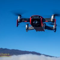
I have downloaded and used both for flight planning applications around the island. The island of Hawaiʻi offers some spectacular scenery that has made learning to fly the drone quite enjoyable.

Basically the official FAA B4UFly application sucks. A blunt expression, but appropriate, it truly does.

Continue reading “B4UFly and AirMap”

Where can you fly a drone in Hawaii?

For a new drone pilot, learning the rules can be a bit daunting.

Hawaiʻi is a state that is incredibly attractive to a drone pilot. The scenery, from reefs and beaches, to the soaring volcanoes, just begs to be flown over and photographed from the air.

Flying the DJI Mavic Air in the saddle at the base of Mauna Kea

I am determined to fly responsibly, that means going through all of the various rules. The rules are not simple! They are a patchwork of regulations from federal, state, and local authorities. How do you make sense of it all?

Below is the results of my research on the subject. More than a few hours of reading state and federal websites. The process of writing this post was in itself a means of educating myself. Hopefully others will find this useful. If you know of anything I have missed, drop me a line to let me know.

This post is focused on the Island of Hawaii, home for me. But much of what is discussed here applies to all of the islands.

Continue reading “Where can you fly a drone in Hawaii?”