Around this island the observant hiker will become attuned to various clues that give a view into the natural history or human history of the landscape.
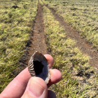
An ʻopihi shell found along a utility line access road far from the ocean
One such clue is the presence of seashells, these are usually a giveaway of ancient Hawaiian occupation of a site or locality. The bleached and broken bits of shell a long lasting remant of meals harvested from the shoreline and brought to places well inland. Often found around lava tubes or water sources these shells let you know that others have passed here before.
An ʻopihi shell along a power line access road near Waikoloa? This is a bit unexpected. I have to stop and pick up this shell, stopping to puzzle out this anomaly.
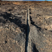
The region south of Waikoloa along the shore seems to be a barren field of lava with little to offer beyond miles of dark rock and baking sun. That may seem to be the case, but there are surprising gems out in those lava fields.
Looking along the King’s Trail south of Waikoloa
The plan? As usual hike the King’s Trail south from Waikoloa, but this time explore some of the smaller trails I had passed by in the past. Perusing the satellite imagery reveals a surprising number of trails through the lava. Considering the substantial effort it takes to cut a trail through the worst aʻa lava those trails must be significant somehow.
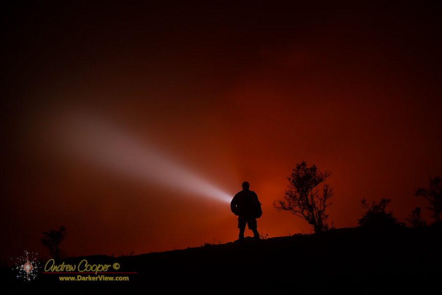
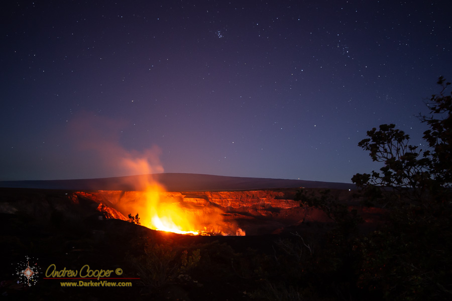
The erupting fissure stretched for nearly a mile across the down dropped block. This block is an enourmous slab of the old caldera floor, a mile across and wide, it had slumped down hundreds of feet during the 2018 Kilauea caldera collapse.
USGS reports had dubbed this slab the “down-dropped block” where it is routinely referred to in the daily reports of eruptive activity. The lower western edge had succumbed to the lava lake slowly filling the lower sections of the collapse pit where the edge of the block had become flooded by the growing lava lake.
This block had slumped down nearly intact, the top still flat, if now somewhat tilted to the west. The old features atop this block still visible including pahoehoe flows, old eruptive vents, and the hiking trail I had once hiked in crossing the caldera floor.
The old Halemaʻumaʻu Trail could still be seen as a lighter path beaten across the black lava by thousands of hiking boots. The trailhead was at the Halemaʻumaʻu parking lot, the pavement of that lot and sections of Crater Rim Drive still visible on smaller slump blocks on the west side of the caldera, also hundreds of feet below the original caldera floor.
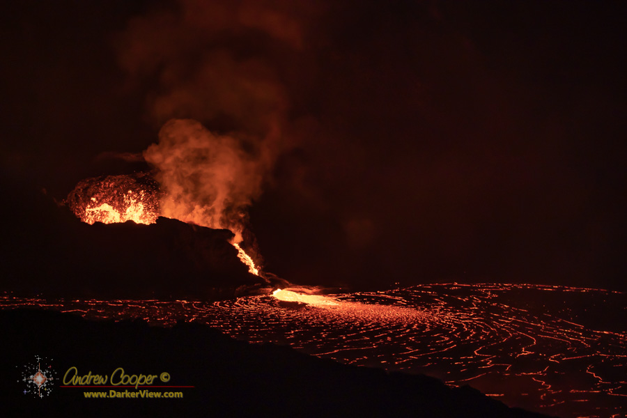
The September 2023 eruption started as a fissure right across the down dropped block. For almost a mile fountains of lava surged and frothed. The down dropped block completely bisected by the eruption.
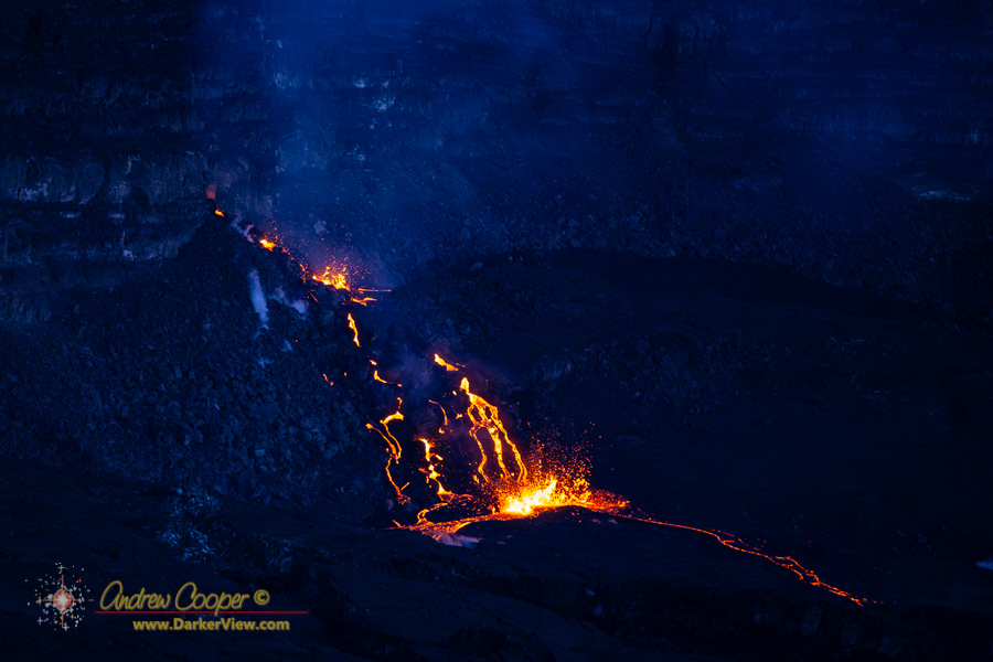
One small vent marked the end of the fissure, right at the eastern end where lava had forced its way through the pile of debris at the cliff that marked the block’s edge. Overlooked by most with far more spectacular fountains to be enjoyed. I found that last little vent fascinating where lava tumbled down through the talus.
I have not had a chance to look again, but I suspect this eruption finally covered over much of that section of the hiking trail. I wonder, one day when the caldera floor is filled by this series of eruptions if there will once again be trails out to cross the caldera, and if I will still be around to hike them.
The easternmost vent of the September 2023 eruption