The island is still dealing with the damage wrought by Iselle. The Puna area took much of the damage with power lines down, fallen trees blocking many of the roads and damage to many houses. Fortunately there have been no reports of any deaths due to the storm. There are still thousands of residents without power as utility crews struggle to deal with the mess.
Residents on the west side saw few or no issues from the storm. We had almost no wind and just a little rain. Our precautions were totally unneeded, I guess we will use the water jugs to water the plants out front. Need to put the lanai furniture and barbeque back as well.
Despite our precautions Keck observatory has had issues due to the storm. Several systems suffered damage due to power line disruptions. We lost a motor controller in the K1 dome, I spent all of Saturday helping to replace that. Just as we were finishing repairing the dome the main breaker for the facility failed, leaving us on generator power. Waiting for word from the crew on restoring power. Until it is repaired we are off-sky. Update: Our intrepid day crew has fixed it. Yes, they are that good.
Hurricane Julio has spared the islands completely, tracking well north, far enough that we are clear of its effects. The storm is generating a big northeast swell that has the surfers looking for waves.
GEOS West 4km IR of hurricane Julio passing north of the islands, the remains of Iselle are seen west of Kauai
Dawn has come with an eerie silence, not a breath of wind. Yesterday afternoon and well into the night the winds ran hard, this morning there is calm. We received no measurable rain, while friends are posting views of Hilo rivers brown and raging. Obviously our internet is still moving bits and the lights still come on when you toggle the switch. The power flickered many times, but did not fail.
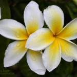
Plumeria (Plumeria obtusa) blossoms on the front lanaiI stand on a lanai stripped of furniture and barbecue grill to smell the plumeria blossoms. The last days seem surreal. The cool quiet broken only by the calling birds of the neighborhood. A scent calls me back inside, Deb is cooking dutch pancakes, a treat to celebrate the morning after the hurricane.
The storm is still here, dropping heavy rains on the south end of the island. Later this morning I will join the summit crew for a late departure to the summit and a quick check of the facility. Fill the instruments with cryogens, do a walk around, and not much more.
Hurricane Julio is still forecast to swing north of the island, sparing us the heavy rains and winds, though we may still feel some effect. It will move past the island on Sunday, as we cast wary eyes on the forecast charts. The coming week will bring a return to normalcy and the frantic activities of segment exchange.
Now at the summit doing a last walk through the facility to insure everything is ready for the storm. A lot of the gear has been turned off to preserve the battery and generator capacity, keeping the network and the key servers operational so we can monitor remotely once everyone leaves.
The winds are picking up, some 60mph gusts along the summit ridge, a little less where Keck sits on the western side. Looking to the east we can see some cloud features that might be the front wall of the oncoming storm.
We plan to depart the summit in another hour and head for home. I expect the drive down to be as clear as the drive up, mostly clear with wild cloud formations over the summits.
Eighteen gallons of drinking water sitting in jugs in the guest bathtub, all of the lanai furniture is stashed away, a supply of propane is on-hand, the vehicle tanks are full… We are prepared for the storm.
Considering that Iselle has failed to weaken as the earlier predictions forecast, it is now going to hit the island as a full hurricane. The cone of possible paths has narrowed to where there is no doubt, the eye of the storm will come right over the island.
I have never experienced the center of a hurricane, this will be new. Getting brushed by the outer edge of hurricane Howard while in Mexico a decade back is as close as I have been before. If the predictions hold we will see the eye go right over us. It will also be interesting to see what the interaction with two nearly 14,000ft mountains will do to the storm.
I am not expecting damaging winds on our side of the island. Perhaps a lot of rain? My worst fear is an extended power outage. There is a lot of Alaskan halibut in the freezer that would be painful to lose. I have filled the remaining space in the freezer with water bottles, now ice, to increase the thermal mass and the hold time without power.
I am on the minimal summit crew that will head up first thing tomorrow morning. We depart at the usual 7am and hope to be off the summit before noon. Certainly before the storm makes landfall later in the day. In any case tomorrow will be an interesting day.
Hurricane Iselle approaching the island of Hawai’i
Iselle is now forecast to hit the island as a full hurricane. The most likely path has shifted a little south, aiming directly for Puna. This may get interesting!
The forecast for hurricane Iselle as of Wednesday morning
A GEOS infrared image of the Eastern pacific on the afternoon of August 5th. Visible are three hurricanes… Genevieve, Iselle and Julio (west to east)First up is hurricane Iselle, currently a category 2 storm with 110mph sustained winds. Fortunately the storm is expected to weaken and cross the island as a mere tropical storm on Thursday. The track does predict that the storm will come right over the island, bringing heavy rains and possibly damaging winds.
Behind Iselle is Julio, now 1900 miles southeast of Hilo. This storm is expected to cross the island as a hurricane, the first hurricane to hit a Hawaiian island in over two decades. This is the storm everyone is watching. It is still a bit early, the storm is not expected to arrive until Sunday. The forecasts will be interesting and well read over the coming days.
The forecast path for hurricane Iselle, 5 Aug 2014Fortunately our house is on the lee side of the island from these approaching storms, and is somewhat better sheltered than many of our neighbors. Storm preparations are quickly accomplished… Secure any outside furniture and gear, and insure we have a little extra water and propane on hand.
Preparations at the observatory are notably more complex.
The major concern is an extended power outage. We rely on long power lines that cross the saddle between Mauna Loa and Mauna Kea. If one or both of these storms prove damaging the power lines are likely to be part of the damage. These lines are also likely low on the list of repairs if there is extensive damage across the island.
Yes, there is a backup generator on site with a storage tank filled with diesel. How long will it last? What if the power lines along Saddle road are damaged? The power lines to the summit may be low on the priority list to repair if there are lines down all over the island.
If we are without power for a long period, we could lose power when the generator runs out of fuel. Of first concern are the instruments… The sensitive interiors of these cameras and spectrographs are kept at cryogenic temperatures, hundreds of degrees below freezing. Without power the instruments will start to warm up. Returning the instruments to service can take weeks. The vacuum dewars will have to be pumped again to restore the high quality vacuum conditions, then the instrument carefully cooled again.
Not that we are plunging blindly into this. We have a plan. Shutting down as much as we can, with priority given to the instruments. Hopefully the worst will not occur and we can continue smoothly on. But if the island does take damage we will be prepared to weather out the worst of it and preserve the facility.