Among the items I found in the NYPL image collection was an 1835 map of the Hawaiian Islands. I included it in the posting on the collection, but the map truly deserves a closer look. It preserves the western view of the islands as of the early 19th century.
The map is reasonably accurate, looking at the coordinates given for key points in the islands shows that they are correctly plotted. The outlines of the islands are mostly familiar. The shapes of Molokai, Maui, and parts of Hawaiʻi do show some odd features that look odd to anyone with a good knowledge of local geography. Any number of points and bays seem exaggerated, note the peninsulas on the north shores of Oahu and Maui. Notably Kealakekua bay is drawn as much more sheltered than it really is, an odd inaccuracy in a maritime map.
Continuing inspection reveals a number of other oddities… There are two islands marked on the map south of Niʻihau, named Tahoora and Papappa. Modern navigation maps mark only one island here, Kaʻula. Tahoora (Kaʻula) was spotted by the Cook expedition and recorded with that name. Reference to Papappa can be found in the 1870 Seaman’s Guide to the Islands of the North Pacific, Part II, W. H. Rosser. Apparently local fisherman reported another island south of Kaʻula. A number of ships looked for such an island in vain. The guide lists its existence as “doubtful”.
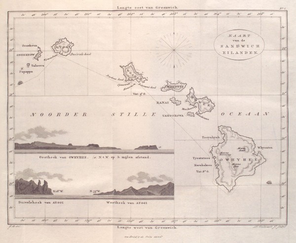
It is also interesting to note that the coordinate system used is referenced to Greenwich. Thus the longitudes marked at the bottom match those found on modern maps. At the time the prime meridian, the location of zero longitude, was hotly contested between several possible locations. It was not until the 1884 International Meridian Conference that Greenwich became the accepted standard worldwide. This was over the objections of the French who abstained from the vote and continued to use the Paris meridian until 1911.
Of course it is the place names that are the most fascinating feature of the map. Setting aside the Dutch vocabulary and looking just at the transcriptions of the Hawaiian place names one sees familiar names as they were used two centuries ago.
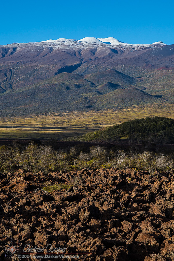
Looking about the map one will note Owhyhee in place of the modern Hawaiʻi, Mowee and Woahoo as the old versions of Maui and Oaho, quite recognizable. If you have read the old accounts you may recognize Atooi as the island of Kauai. We also see Mowna Kaah printed on the map for present day Mauna Kea, similar to the Mauna Kaah found in the Cook expedition journals as the first written version of the mountain’s name.
| Map Name | Current Name |
|---|---|
| Atooi | Kauai |
| Honoruru | Honolulu |
| Karakakooa | Kealakekua |
| Mowna Kaah | Mauna Kea |
| Mowna Worroray | Hualālai |
| Mowna Roa | Mauna Loa |
| Morokinne | Molokini |
| Morotoi | Molokai |
| Mowee | Maui |
| Oneeheow | Niʻihau |
| Oreehoua | Lehua |
| Owyhee | Hawai’i |
| Ranai | Lanai |
| Tahoora | Kaʻula |
| Tahoorowa | Kahoʻolawe |
| Woahoo | Oahu |