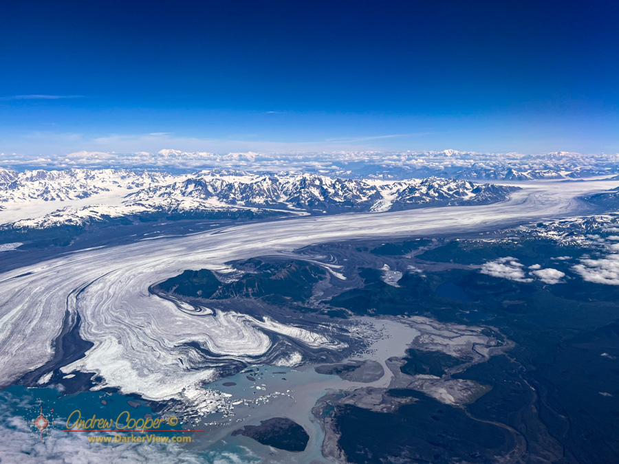
It is big. Really, truly big.
The glacier looked to be miles wide and flowed from deep in the mountians to where it nearly reached the sea. My view from the aircraft window allowed a perfect view on a beautiful sunny day. Unlike previous times I had passed this way no clouds obscured the scene.
It took a quick look at the map after the flight to identify the glacier I had seen and photographed… Bearing Glacier, the largest glacier in North America.
The glacier starts at an icefield in the St Elias Range, a stunningly rugged mountain range that abruptly rises from sea level to heights near 20,000ft in places. From there a five mile wide river of ice decends over 50 miles to the coastal plain, ending in Vitus Lake dotted with icebergs broken from the glacier’s terminal face. Seal River, a short, two mile long river then drains glacial meltwater into the Gulf of Alaska.
The numbers fail to capture the sheer grandeur of the that river of ice. While the view from 30,000ft was impressive, I wonder what it would be like to stand in the middle of that expanse on such a beautiful day.