Sheridan Galcier

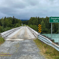
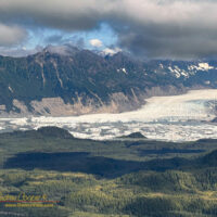
Southeast Alaska has so many glaciers, but very few of them are easily accessible. Most require long hikes into wild coutry, floatplanes to remote lakes, or boating through iceberg choked waters to reach. Sheridan Glacier you can drive to.

Icebergs scattered across the lake in front of Sheridan Glacier

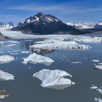
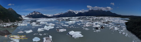
The glacier is only a few miles from the airport reached by a short gravel road, and an even shorter trail through the woods. Not the glacier itself, as that is about a mile away on the other side of a lake. Rather you reach the shore of a lake covered with icebergs, creating a spectacular scene with the glacier in the background.

At the end of the road the glacier is just visible through the trees as glimpses of ice. A well maintained US Forest Service trial leads to a point from which some of the lake and glacier can be seen.

Sheridan Glacier viewed from an aircraft landing in Cordova

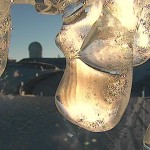
This first viewpoint has a clever feature. Here you find a simple post with a small recess milled into the top. You can place a cellphone on the post and take a photo. Sending the photo to an email address allows the Forest Service to monitor changes in Sheridan Glacier over time. Not by installing their own expensive remote camera, but rather by simply having visiting tourists contribute their photos.

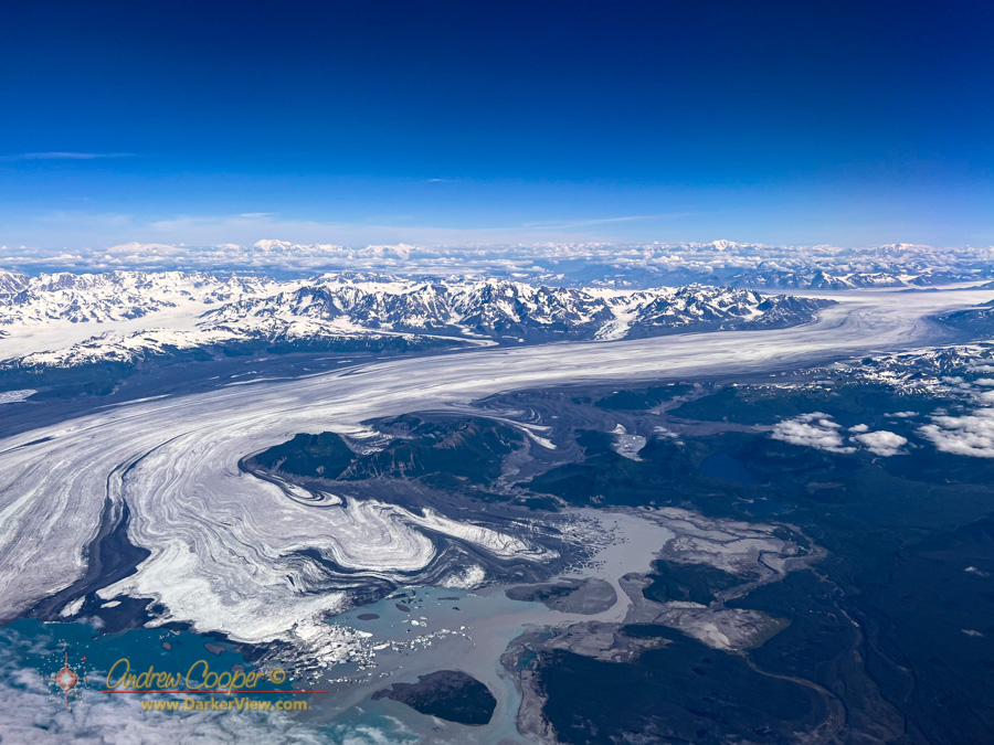
Going a bit further, my brother and I hiked the short trail around and down to the shoreline looking for a better view of the iceberg covered lake. Where the trail emerged again onto the shore a small moriane offered the view we were looking for, a place to sit and enjoy spectacular scenery. From this little moraine also flew the drone to gain a better vantage for some photos.

The lovely weather would not last long, it was a good decision to use this first afternoon in Cordova to get out and see the glacier and explore further to the end of the road.

Sheridan lake with scattered icebergs from Sheridan Glacier

Bering Glacier

It is big. Really, truly big.

The glacier looked to be miles wide and flowed from deep in the mountians to where it nearly reached the sea. My view from the aircraft window allowed a perfect view on a beautiful sunny day. Unlike previous times I had passed this way no clouds obscured the scene.

It took a quick look at the map after the flight to identify the glacier I had seen and photographed… Bearing Glacier, the largest glacier in North America.

The glacier starts at an icefield in the St Elias Range, a stunningly rugged mountain range that abruptly rises from sea level to heights near 20,000ft in places. From there a five mile wide river of ice decends over 50 miles to the coastal plain, ending in Vitus Lake dotted with icebergs broken from the glacier’s terminal face. Seal River, a short, two mile long river then drains glacial meltwater into the Gulf of Alaska.

The numbers fail to capture the sheer grandeur of the that river of ice. While the view from 30,000ft was impressive, I wonder what it would be like to stand in the middle of that expanse on such a beautiful day.

Bering Glacier seen from the west

To the End of The Road

There is only so much road to explore and we explored much of it.

Dangerous River
The Dangerous River bridge at the end of the road.

Yakutat, like so many Alaskan communities is accessed only by sea or by air. Not to say there are no roads, they just do not go anywhere else, much less connect to the road network that crosses the continent.

In the case of Yakutat the furthest you can get from town is about 26 miles as the crow flies taking the road to Dangerous River and Harlequin Lake. This road is a well maintianed gravel road heavily used to access popular fly fishing rivers and hunting areas, as well as by loggers harvesting the local hemlock and sitka spruce.

Continue reading “To the End of The Road”

A Little Icy…

Snow Gallery

This winter has already seen quite a bit of snow atop our tropical summit. It seems appropriate to put together a few recent snow photos…

Winter is Here

Today marks the beginning of winter. While snow and ice can appear on the summit of Mauna Kea any time during the year, the most severe weather usually occurs during winter storms. We all look forward to the beautiful sight of Mauna Kea with her white coat. Of course this comes at a price, days of difficult access to the summit facilities, or no access at all. The loss of observing nights due to ice and clouds is most common from January to March.

Iced
The emergency evacuation vehicle covered with ice

White Mountian

A great deal of mythology swirls about our mountain. Some of it may be true, much is probably not as wishful thinking and reality collide on the summit. The current debates have moved every little detail into the light.

Mauna Kea White
Mauna Kea with a fresh covering of snow and ice
One of the claims I have heard repeated a few times recently is that in the past Mauna Kea always had snow, even in summer, making the name “White Mountain” very applicable.

I had my doubts about this. Whenever these questions arise it is important to check the records. Fortunately this has already been completed for us… Norbert Schorghofer, Elianna Kantar, and M. Puakea Nogelmeier at the University of Hawaii combed through the historical records looking for observations of the presence of snow atop Mauna Kea. What they found is that there were any number of records indicating the lack of snow on the mountain.

Follow the link and read the paper, it is a fascinating view into the past of Mauna Kea. Included are excerpts from ships logs and diaries of early visitors to the islands. At the end is a convenient timeline of the accounts covering the first century of written records and a set of three conclusions drawn from this information. The author’s conclusion is clear, Mauna Kea has not featured permanent snow cover any time in the last few centuries.

There was a time when the mountain featured permanent snow and ice fields. During the last ice age, around 12,000-11,000 years ago, there was permanent ice and active glaciers in the summit region. Along the access road there are textbook glacial features to be seen, glacial polish and moraines. This was gone before humans arrived in the islands. What we see today was probably much as it was over the past few centuries, as borne out in the records of the first European voyagers to make it to the islands. Snow may have been more common, but there were certainly periods when no snow was to be seen atop the summit of Mauna Kea.

These historical accounts date from long before human activities had begun dumping vast quantities of carbon dioxide into the atmosphere. We do face an uncertain climate future, warming temperatures may reduce snowfall. The opposite may also be possible, warmer sea surface temperatures may create more precipitation at the summit with heavier snowfall events possible.