Please Define Normal

We are now more than two months into this new eruption from Kilauea. Two months ago the fissures opened in the Leilani Estates subdivision and homes began to burn.
Fissure 8 Lava Fountain
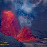
The lava fountain at fissure 8 in Leilani Estates throwing lava hundreds of feet in the air on June 4th, 2018
For two months this slow motion catastrophe has continued. While a major earthquake may be over in minutes, or a hurricane over in a few days, this eruption just goes on. For the folks in lower Puna the lava continues to destroy homes and disrupt lives.

For those of us outside the eruption zone things are not quite as immediate. We read the daily news, peruse images of helicopter overflights each morning, and wonder when it will be over.

The multiple county civil defense status reports and various emergency alerts that pop up on our phones each day provide current information… A bit of the Mamalahoa Highway has collapsed in Volcano Village with a one lane restriction, the road to Kalapana has re-opened, there is no tsunami threat from that last 5.4 magnitude earthquake.
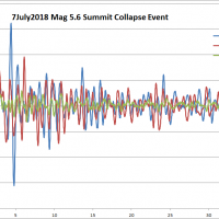
July 7, 2018 Summit Collapse Earthquake
A plot of the July 7, 2018 summit collapse earthquake as recorded by an accelerometer in the Keck Observatory foundation
Every day is punctuated by a magnitude five point something earthquake. These summit collapse events have become very regular. You can guess when they will occur as the frequency of small quakes increase around the caldera.

For the most part these events pass unnoticed by much of the island. The volcano area gets shaken up pretty well, but these fifth magnitude quakes are often not felt very far beyond that.

On the summit of Mauna Kea these daily quakes often do disturb the telescopes at night, bumping the tracking and ruining exposures, but otherwise too weak to cause any damage to the facilities.
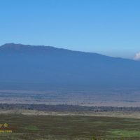
Hualālai peeks over a thick layer of volcanic smog, or vog
The most significant island wide impact has been the vog, wreathing the island in a sulfurous haze. Sulfur dioxide pours from the active vents, mixes with water in the air and forms a thick brown grey haze.

When the vog is bad you not only see it, you smell the sulfur, it irritates eyes and nasal passages. Fire and brimstone reaches out to touch us all.

While the vog makes for spectacular sunsets, the vog can also be thick enough to curtail outside activity. A day like today, with brisk trade-winds to clear it away, is a welcome relief.
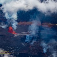
Fissure 8 Lava Fountain
The lava fountain at fissure 8 rising about 250 feet as this Kiluaea eruption continues unabated.
Opportunities to legally witness this eruption are few, authorities have been enforcing the evacuation area increasingly strictly. Legal options are the fly or float to the eruption. Deb and I chose to fly a month ago, a helicopter flight I am sure we will remember for a lifetime.

I have not attempted to go to photograph the lava river, despite a very strong desire to do so. The county and state have repeatedly talked about opening a lava viewing area. while there is a great deal of pressure from the community, so far nothing has materialized.

We are so ready for this eruption to be over.

Given the collapse of the summit caldera and the enormous volume of lava emitted so far, it may be possible that when this is over there will be no further eruption for a while. It may take a while for the volcano to recharge, perhaps a year or two. Will we return to the pattern of intermittent eruptions that was seen through much of the 20th century?

The Vog is Bad

Step outside and you can smell the sulfur… In Waikoloa!

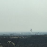
Kona Airport in the Vog
The Kona airport wreathed in vog on May 29, 2018
This is a first. The vog has been bad, but never this bad, the entire island is wreathed in a heavy haze of volcanic emissions. As I write this I feel my eyes are irritated, stepping outside you can see it in the streetlights.

Deb and I drove to Kona this afternoon. The usually pretty drive was simply gray, gray with a tinge of yellow-brown. No views of the mauna, no views of the ocean. You could barely see the airport from the highway as we passed.

The vog has been the subject of conversation everywhere, online in social media, and in every single casual conversation you happen into today. The volcano, so devastating to those in lower Puna, has reached out to touch us all.

Vog map May 29, 2018
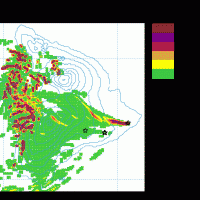
The vog mapping done by the University of Hawaii showed that mid-day, the vog was sweeping right through the Saddle at Waikoloa and the Kona coast from the current eruption site in lower Puna. Fortunately the predictions are for resumed northeast trade-winds tonight, clearing much of the island of vog into tomorrow.

Things could be worse. An explosion at the caldera today showered surrounding communities with ash and Pele’s hair. Plus, there is much to be said about not having a lava flow, or three, flowing though your neighborhood.

Voggy Luna

The vog has been thick, really thick. Even here on the west side of the island it is enough that visibility is limited to a few miles, the mountains and ocean are lost in the haze. With the ongoing eruptions on the other side of the island and a lack of wind the vog has enveloped the entire island in gray. At times you can even smell it, the tang of sulfur in the air.

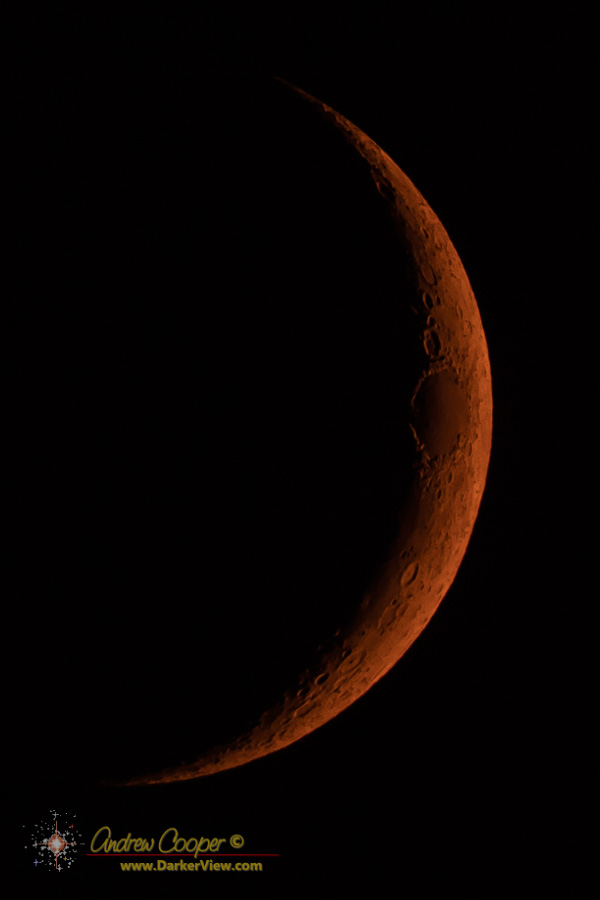
As the crescent moon set this evening it was reddened by the vog. Washed with a ruby red that was reminiscent of an eclipse. This image has been processed for noise and contrast, while the color was unchanged from the raw image. It really looked like this…

Voggy Luna
The setting crescent moon reddened by volcanic haze.

Spotting Kahoʻolawe

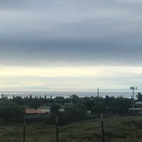
Twice in two weeks I have now seen Kahoʻolawe, this also marks the second occasion I have seen the island in almost a year. You might think me a little crazy, but I swear, I really have seen it! Look, I have a photo!

Kahoʻolawe from Waikoloa Road
The island of Kahoʻolawe as seen from Waikoloa Road
Seeing this island should be a regular occurrence… It is right on the horizon as seen from Waikoloa, right in front of you as you drive down Waikoloa Road. Even if barely visible I would recognize it, I know right where to look and would recognize the distinctive profile.

Continue reading “Spotting Kahoʻolawe”