When will this eruption end? The answer to that is a question many are asking on this island. Today we might just be seeing the answer.
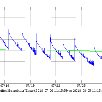
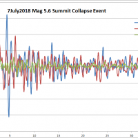
Even more interesting is the deformation data from the summit.
When you want to see the stars, find someplace dark

Exploring the Puna district
When will this eruption end? The answer to that is a question many are asking on this island. Today we might just be seeing the answer.
Even more interesting is the deformation data from the summit.
It is the question everyone on the island would like an answer for… How long will this eruption last?
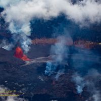
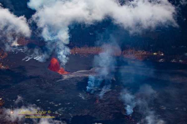
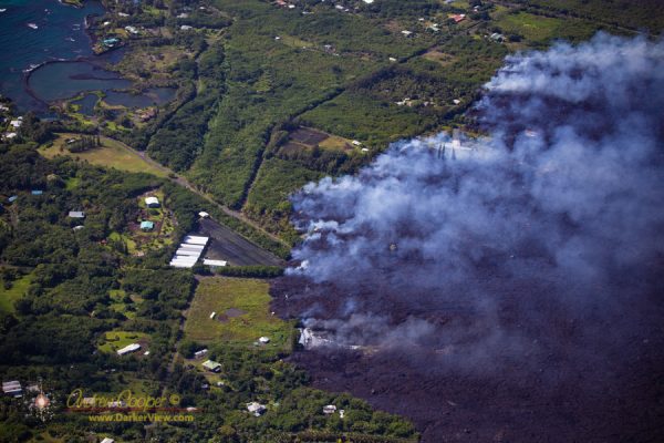
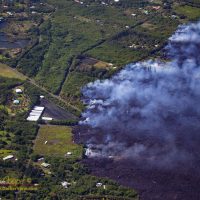
This lava has covered much of the Kapoho area and built new land out almost a kilometer beyond the old shoreline into waters that were once over hundreds of meters deep. In the process well over 700 homes and farms have been destroyed and permanently altering the landscape of the Puna district.
We are now more than two months into this new eruption from Kilauea. Two months ago the fissures opened in the Leilani Estates subdivision and homes began to burn.
For those of us outside the eruption zone things are not quite as immediate. We read the daily news, peruse images of helicopter overflights each morning, and wonder when it will be over.
The multiple county civil defense status reports and various emergency alerts that pop up on our phones each day provide current information… A bit of the Mamalahoa Highway has collapsed in Volcano Village with a one lane restriction, the road to Kalapana has re-opened, there is no tsunami threat from that last 5.4 magnitude earthquake.
For the most part these events pass unnoticed by much of the island. The volcano area gets shaken up pretty well, but these fifth magnitude quakes are often not felt very far beyond that.
On the summit of Mauna Kea these daily quakes often do disturb the telescopes at night, bumping the tracking and ruining exposures, but otherwise too weak to cause any damage to the facilities.
When the vog is bad you not only see it, you smell the sulfur, it irritates eyes and nasal passages. Fire and brimstone reaches out to touch us all.
While the vog makes for spectacular sunsets, the vog can also be thick enough to curtail outside activity. A day like today, with brisk trade-winds to clear it away, is a welcome relief.
I have not attempted to go to photograph the lava river, despite a very strong desire to do so. The county and state have repeatedly talked about opening a lava viewing area. while there is a great deal of pressure from the community, so far nothing has materialized.
We are so ready for this eruption to be over.
Given the collapse of the summit caldera and the enormous volume of lava emitted so far, it may be possible that when this is over there will be no further eruption for a while. It may take a while for the volcano to recharge, perhaps a year or two. Will we return to the pattern of intermittent eruptions that was seen through much of the 20th century?
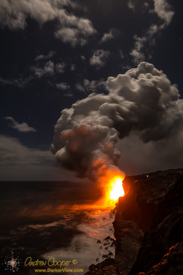
Puna is glowing.
Not a good glow when you consider that glow is from a raging river of lava between fissure 8 and the sea at Kapoho. Still it can be pretty under the rising Milky Way. I stayed late at work and took a few photos on the way down the mauna. Click on the image for full scale goodness…

One of the most beautiful places on the island is gone.
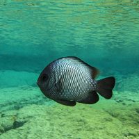
And they were popular, on any given day a couple dozen locals and tourists could be seen exploring the pools. You could swim across one or two, then have to climb across a few feet of old pahoehoe lava to drop into the next. The more adventurous were rewarded with even richer coral in the outermost pools where the ocean waves created more challenging swimming conditions.
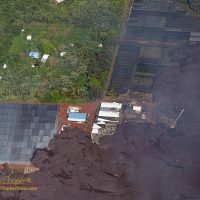
One of the most poignant scenes we witnessed was the many farms destroyed by the lava
Houses are bad enough, seeing the farms in front of the lava flow was worse. I found myself looking through the telephoto lens at the neat greenhouses, the orchards green in the morning sunlight. The wide flow front was in the process of destroying so many farms, remorselessly moving through the neat rows of papaya trees.
I understand that some of our family can be a bit fuzzy on island geography. We have had a few exchanges with family members over the last couple days where we have had to remind them that we live on the other side of the island from the volcano. Yes, we are just fine and in no danger from the new eruption.
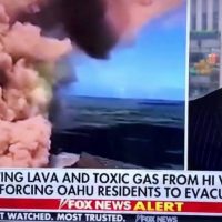
Like Fox News.
At least our family members understand the difference between Hawaiʻi Island and Oahu. But a national news network? I guess that to many Oahu is Hawaiʻi, rather in the same way that Los Angeles is California. Shall we just ignore 230 miles of Pacific Ocean and a few other islands in the way.
Yes, Deb felt the earthquakes in Waikoloa, but they were not bad. There was not even a broken glass at the house despite a magnitude 6.9 earthquake at the the other end of the island. We are 65 miles and two very large mountains away from the volcano.
I was at work and experienced the earthquakes at the summit. Mag 6.9 is now my personal record for strongest earthquake felt, I really do not need to feel anything larger.
While we are safely away from the new lava flows, there are many who are not. It is hard to describe my emotions when seeing video of a house burning as the lava pushes through. Nicely kept gardens surrounding the house betray the effort and pride of the home owner. You can feel dimly the shattering loss of a home and everything that goes with it.