
Stone Wall
When you want to see the stars, find someplace dark

Waimea, Waikoloa and Kawaihae


While writing up my visit to Goat House Tube I was again wondering how old the lava tube was, it is clearly old, but how old?

Most of the Mauna Kea lava flows upon which Waikoloa sits are ten to twenty thousand years old, but the Mauna Loa flows that start just south of the village can be quite a bit younger.
Just a few miles south of the village one can find the 1859 Mauna Loa flow, the longest lava flow in the state representing a very long eruption that produced an enormous volume of lava. This is the flow that reshaped Kiholo bay, destroying the large fishponds that could once be found there.
Continue reading “Geology of Waikoloa”

The region south of Waikoloa along the shore seems to be a barren field of lava with little to offer beyond miles of dark rock and baking sun. That may seem to be the case, but there are surprising gems out in those lava fields.
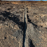
The plan? As usual hike the King’s Trail south from Waikoloa, but this time explore some of the smaller trails I had passed by in the past. Perusing the satellite imagery reveals a surprising number of trails through the lava. Considering the substantial effort it takes to cut a trail through the worst aʻa lava those trails must be significant somehow.
Continue reading “The King’s Loop”
An interesting petroglyph… One has to wonder what the artist was trying to convey here. If we could only ask.
